Our 100 Day Trek through the US of A, part 17, Moab
I knew of Moab only as a Semitic tribe from which people with questionable morals, such as Lot and his daughters sprung. The people that named this town, founded on a canyon floor, had obviously the same type of thoughts, because the city historians reference heated discussions about the name, that actually stems from the Indian name "Moapa" or mosquito.


We find ourselves here for three nights to visit two National Parks: the Arches and the Canyon Lands. May I say this, and I can hardly believe that I am going to write this down, but I think I have seen these parks before somewhere in my recent past.

 |
| All alone: A last one Standing? |

This seemingly blasé attitude came to the fore in "staying in" behavior till mid afternoon before climbing in the car for a quick tour around one of them.
 |
| Newspaper Rock |
 |
| The wheel was invented |
Actually not completely true. On our way into town we sojourned into a lesser visited southern entrance to Canyon Lands and visited a few viewpoints, got out of the car, peered over and said "not bad" and returned to our cool car. 100 plus degree weather, even if it is a dry heat, does not really invite long walks. Although the "newspaper rock" was definitely worth the trip, allowing us to look at "BC" depictions of life, as well as "only" 800 year old messages for us the readers.
 |
| The Shoe |
After checking into our little apartment we ventured out again around 6 pm to see a sunset over the Arches landscape, which was partially successful. I never got an Arch or Butte or Mesa and a sinking sun together in one picture, but I got a moon shot, and a wonderful sunset.
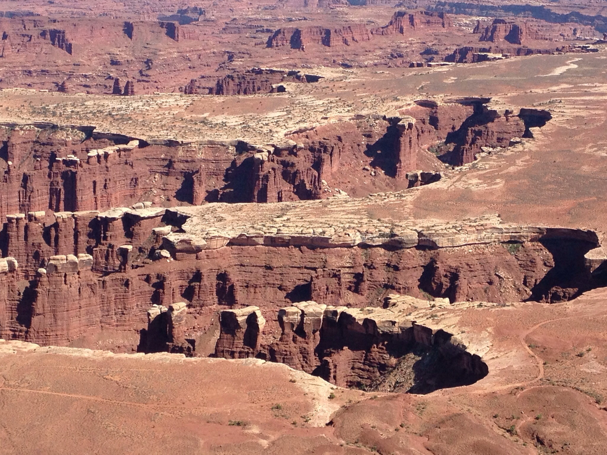
 The northern entry to Canyon Lands showed to be no comparison to the Grand Canyons, but we got the thrill of our lives, when I was allowed to descend 1000 to 1500 feet down a vertical canyon rim in Hansie, with my sweet bride white knuckled besides me.
No picture can describe such a ride, but maybe words can: when you drive the first 500 feet of gravel road high above the canyon floor you see the road disappear in front of you and when you take your first right corner clinging Hansie to the canyon wall a few feet from the edge and look across the divide to the wall you will be driving, you actually see only a 1000ft plus straight drop and no road at all.
 |
| Start of my descent |
 |
| Half way down shot |
 |
| Where is the road? |
As you come closer to that side you see a ledge that from this distance may let a bicycle traverse, but surely no car. This winding and turning takes about half an hour with hairpins that require a 3 mile an hour speed and almost a 300 degree turn hugging the wall of the canyon now looming way above you and with still a canyon floor that seems too far away to be ever reached.
 |
| 6 layers down to go I count |
When at last on the canyon floor we still needed to drive 32 miles on clearly 4WD required roads with so called high clearance. The canyon is so much more (in romantic terms) grand and towering and the road makes you feel as if you are transported back in time to the age of the prospectors and their donkeys. The lonesomeness only adds to that sense of being a speck in a timeless environment.
 |
| The Missouri |

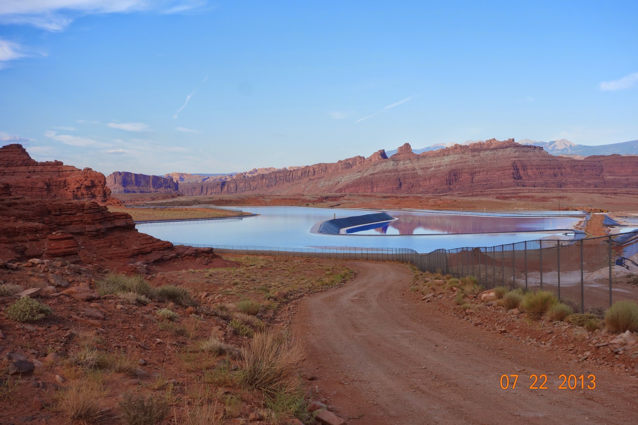 |
| Salt beds in the making |
At the end of this journey we encountered a salt factory where we were warned that we entered private territory, but that we were welcome to traverse as long as we stayed on the mapped road. When at last we arrived back on the asphalt alongside the river that accompanied us out of the canyon, still driving right below a sheer cliff wall on our left, we found many a parked car and rock climbers scaling the 90 degree wall. I almost wanted to lower my window and yell: "I just scaled 90 degrees down in a car".


 |
| Sand stone layers from eons back |
 |
| This balancing act will come down one day |

More sunset and moon pictures


Comments
Post a Comment