Around The World for a 3rd Time (South Island of New Zealand)
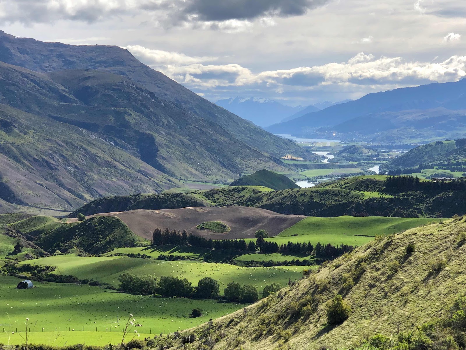
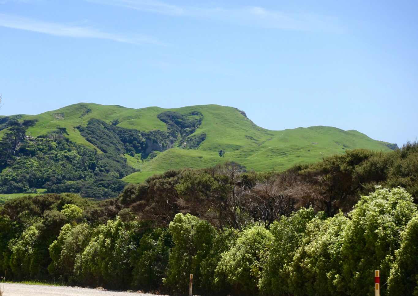
(South Island is one big nature park with expansive views like this)
This is the tale of a November 2018 month long trip on one of the most diverse as well as beautiful islands in the world, during which we experienced typical weather phenomena normally only encountered in the northern hemisphere in March or July or September or December, but never all of them in one month’s time, as we had the pleasure to witness this time around. November in New Zealand is like May in our Northern hemisphere, so one has certain expectations of springlike conditions with the gradual forewarning of summer to come. Reading this blog and looking at the pictures will illustrate the weather surprises we had.

(Its is a very green island with the whole range of greens)
(Filled with mountains and lakes)

(And flowers everywhere)

(But nature can be brutal and unpredictable too)
Our third time around the world was inspired by the desire to see two countries again: China and New Zealand. As I write this now, I would add for future reference: Japan is also a place I won’t mind returning to.

(But the lasting memory that stays with you is green, very green)
In 2014 we visited the North Island of New Zealand, but we heard so many stories about the natural beauty of the much less populated South Island, that we decided then to return one day to this wonderful but far away country. Of the 5 million inhabitants only 1 million live on the larger South Island.

(Agriculture and husbandry is the economic driver]

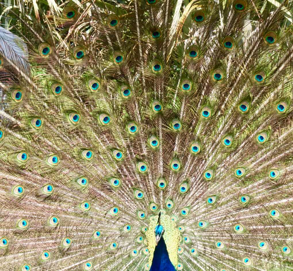
(With more exotic animals in the mix)
It was a beautiful sunny spring day, when our Kia rental car left the airport at Christchurch, which would also be our last stop before leaving for Abu Dhabi and Dubai. Our aim that day was to take the scenic drive north to Kaikoura town, where we expected to take a sperm whale watching boat tour, since Kaikoura is THE place to see whales.
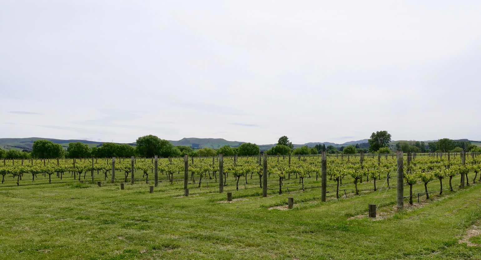
(Vineyards and viniculture is big in New Zealand)

(Nicky’s parents are the caretakers at the property)
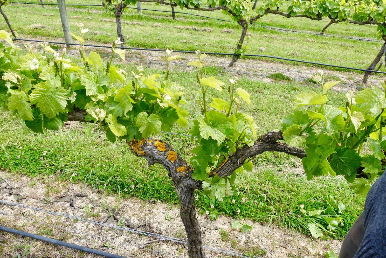
(Beautifully maintained vines in the early stages )
Our lovely drive had us stop and visit a vineyard that produces wines Sandee and I drink and we were looking forward to meet the owner Nicky Parris. We were welcomed by her father Peter who gave us the tour. When he waved us goodbye, he did so with a bottle of his white wine for our later enjoyment.
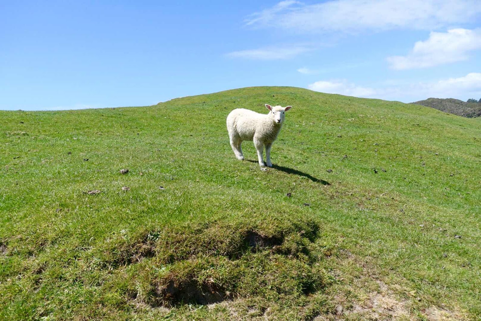
(Did I already mention that there are more sheep than people here)

(This farmer displays a former occupant of the land)
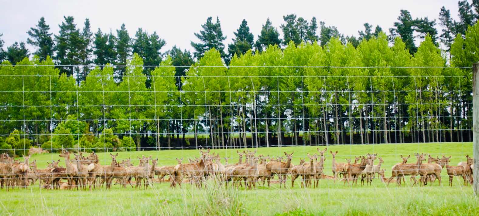
(Deer meat is big too and they turn their heads, like soldiers during a parade: all eyes fixed on us)
The pictures of that day’s drive best tell the story of our first encounter with this part of Kiwi land. The whale-watching tour was cancelled due to rough weather.

(Vista’s and low hanging clouds)
So the next day we went earlier than expected on toward our next stop: Ruby Bay on the north west side of this island. On the South Island most people are living on the coast or in the only 2 big cities here. (And the numbers for biggest and second biggest city on this island is telling: Christchurch has 364,000 citizens and Queenstown number 2 on this island has 10,400 citizens) The midday stop for lunch was in the even smaller town of Picton where the ferries to and from Wellington on the North Island are.
(He showed us)
(All those shades of green)
The weather had turned clammy cold and rainy, but that condition landed me a very expensive nice gift from my sweetheart: a merino wool and possum fur sweater, that only can be bought in New Zealand and sometimes in Australia.
The possum and the polar bear are the only animals with hollow fur, that captures and holds the emitted heat of one’s skin.
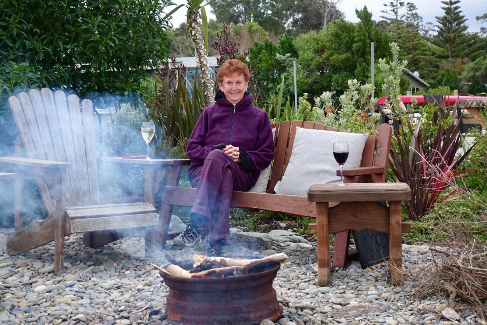
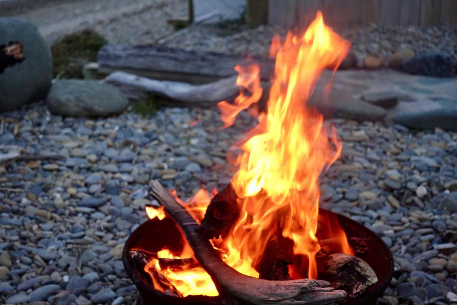
(End of day drinks at the beach with a fire made of driftwood we collected)
(The delights of an well placed AirB&B)
(We took a boat tour in the national park)
(Had views like this)
(Same views from afar on a beautiful sunny day in paradise)
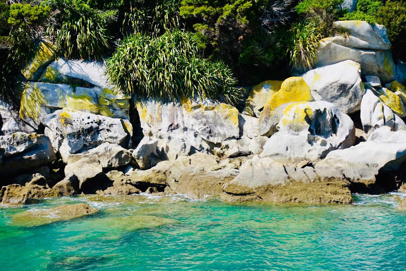
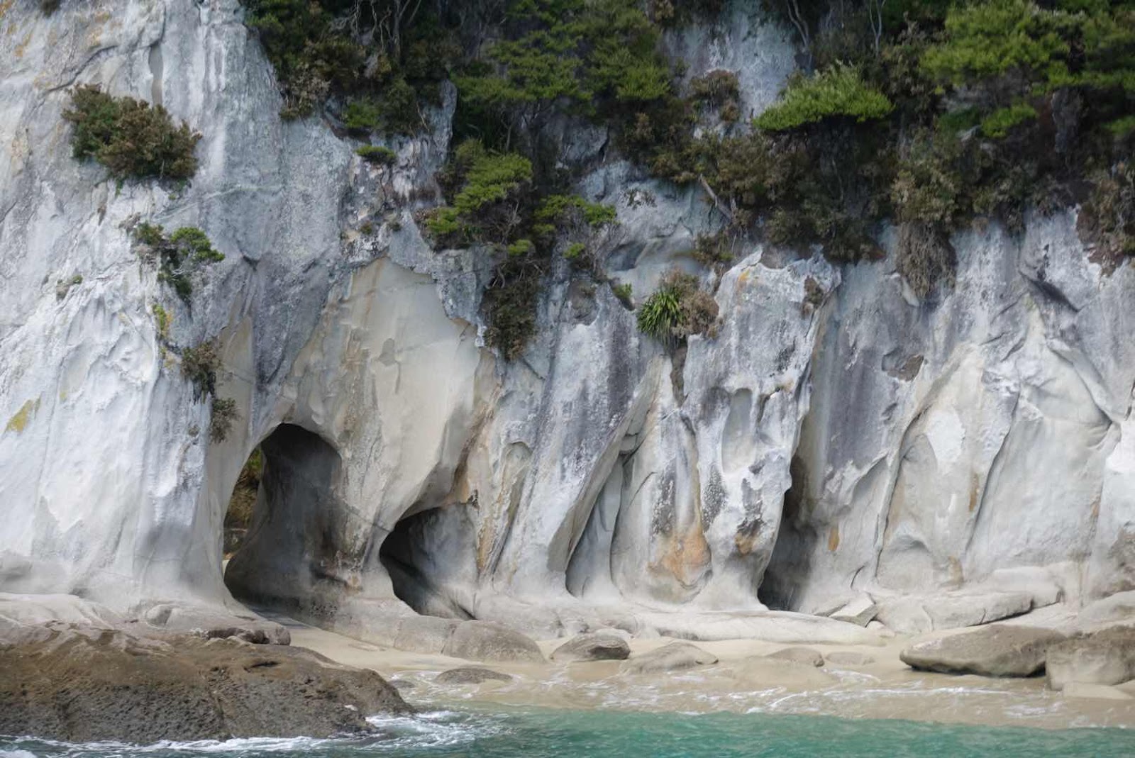
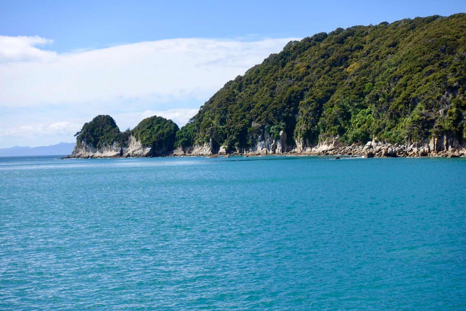
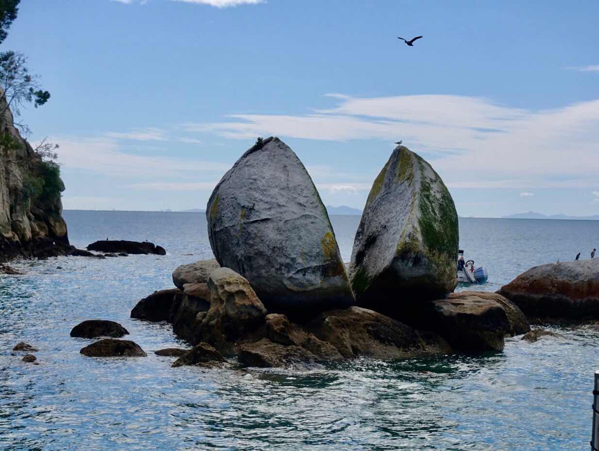
Our lovely Ruby Bay Air B&B gave us the opportunity to not only enjoy a fireplace, the beach and the outside fire pit kept burning with our trove of dry driftwood with views of the Bay, but also served as our base to visit the Abel Tasman National Park and Farewell Spit, the most northern point of this island. Highlight was the walk towards one of the loneliest beaches we ever set foot on, where the wind swept away our footsteps in seconds behind us, as if to stress that nobody was here before or after our visit. we also saw the famed Split Apple during our water taxi ride in the Abel Tasman National Park towards Tinga Quarry from where we hiked 2 and a half hours back to Medlands Beach where the water taxi collected us again to get us back to our car.
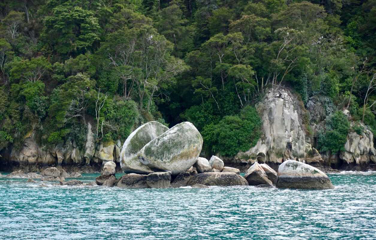
(Above and below pictures of nature’s wonders: a perfect smooth split)

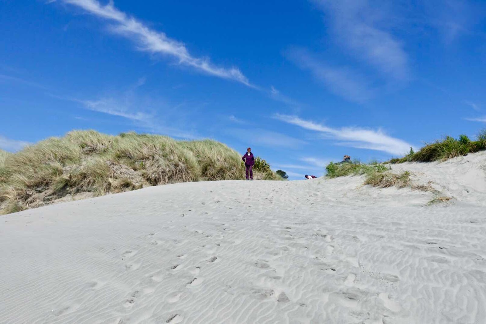
(Our path to the beach at Farewell Spit)
(The wonder of being alone on a wide open beach)

( No footsteps anywhere but your own, which the wind erases right behind
you in a few minutes)
After 3 nights we drove off to change locations and vistas to the Bealy Hotel near Arthur’s Pass. I dearly wanted to take a stop to visit an old miners cemetery named Lyle, where I hoped to find 80 graves. When we drove into the large parking spot where many a caravan had overnighted, as it is also a starting point for a trek into the mountains, a sign warned us not to go direction cemetery since there had been a “slip”, the NZ term for landslide. Stubborn as I am, I walked to see where and how bad the slip was and although half the path was gone we inched ourselves to the other side finding a badly maintained desolate cemetery with only 6 headstones from the 1850’s, 3 of which were women and one had strangely enough a flower blooming right in front of the headstone.

(No dogs allowed on this bridge. More forest on the other side]

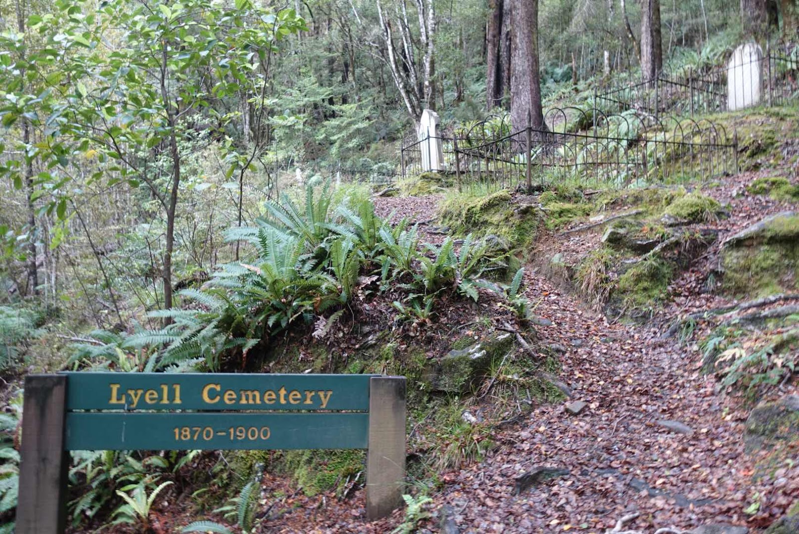
(The cemetery I had to see despite the dangers of getting there)
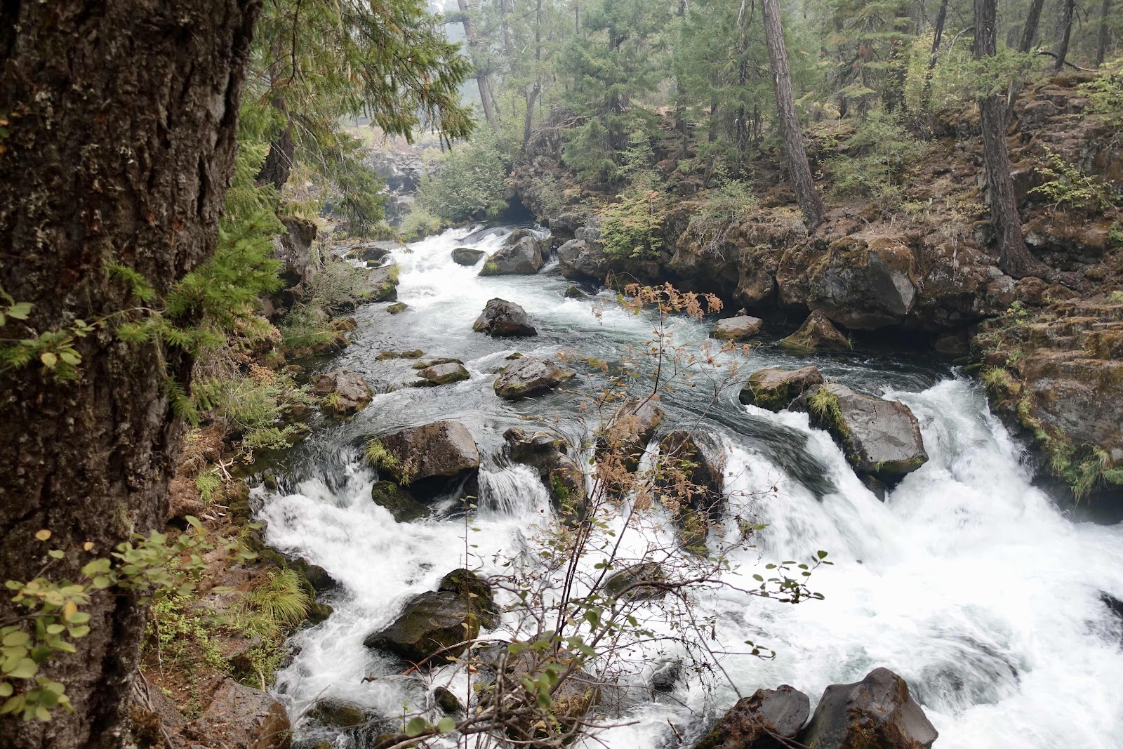
(This is not a rainforest but water streams everywhere)
(The cemetery I had to see despite the dangers of getting there)

(More than a century later nature still honors her)
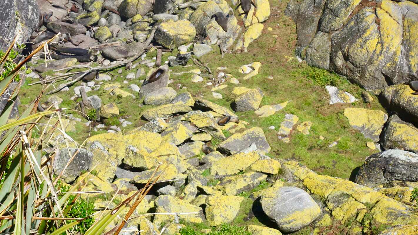
After passing the town of Westport we saw a sign directing us to Faulwind Point, where it indicated we would find a seal colony. The wind had increased a bit but the sun stayed with us as we walked among other visitors staring at an angry ocean, passing a local rare endangered bird that cannot fly named Weka. The fur seals we saw from above sunning on cliffs were worth the detour as was the Weka, a chicken-like brown bird, which we never saw again.
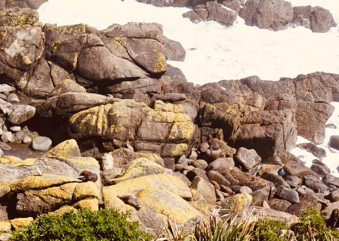
(Seals from high above)
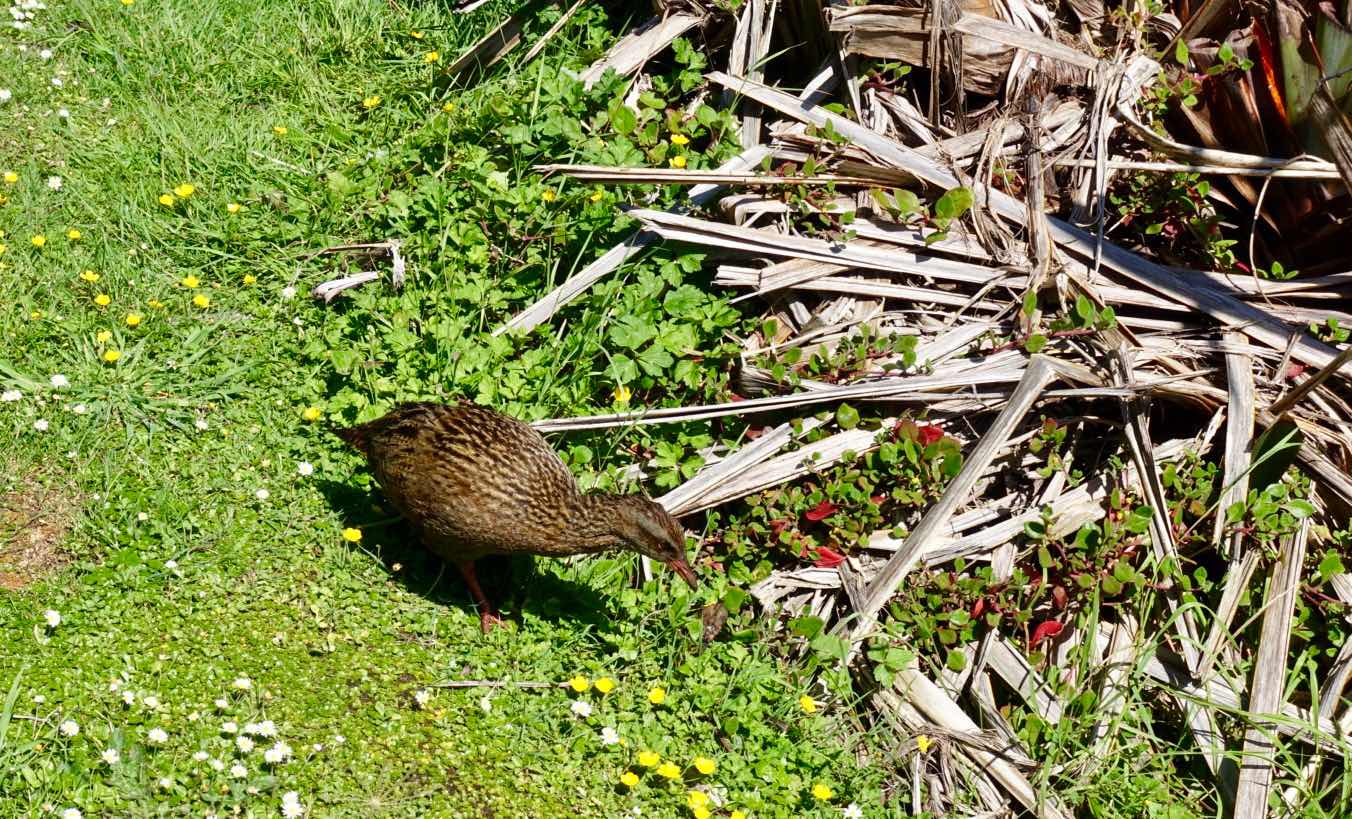
(The elusive Weka we encountered )
The island has a mountain range (Southern Alps) straight in the middle from top to bottom, with 4 passes that allow for crossing from one side to the other. In the middle of the island is the most visited Arthur’s Pass crossing, connecting Christ Church with the small town of Greymouth. (There are no big towns on that side of the island). In 1864 Arthur Dudley Dobson was commissioned to find a suitable pass across the mountains. The treacherous pass he found lies 940m high and was often used by Maori hunters. Later the stage coach brought 8 male passengers for an average monthly wage, during a 35hr road trip from East to West and vice versa. (it could only take 6 women because of their skirts).
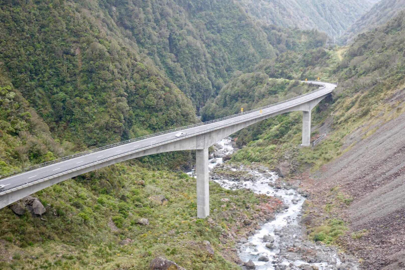
(Today’s easy option to cross Arthur’s Pass)
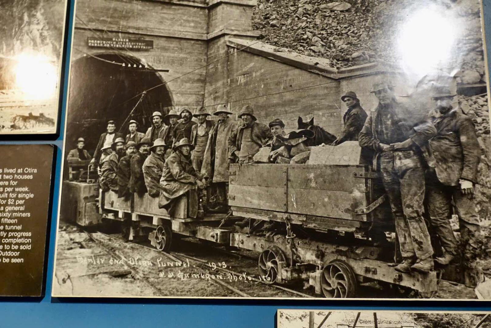
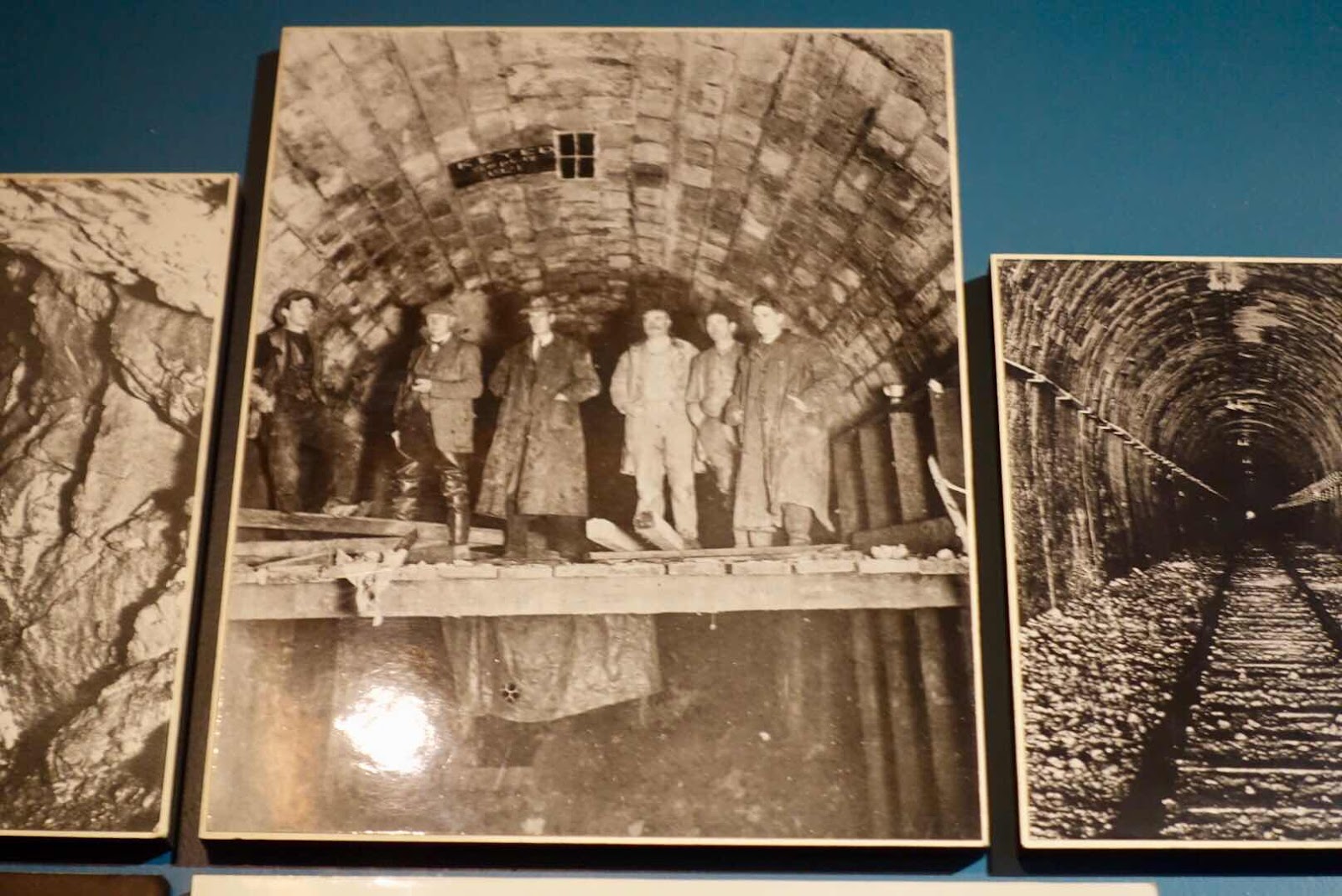
(Pictures of boring the Otira tunnel)
In 1908 construction of the Otira tunnel started from both sides where crews of 60 men earning $1 a day were hacking away at the rock, advancing, depending on its hardness, 60cm/24inch to 4 meter/158 inches a day. The camp where they lived did cost $2 a month and they had to pay $2 a week for food being cooked by women who maintained the camp and cooked and laundered (I did not find out at the little exhibit in the visitor center of Arthur’s Pass what the laundry price was, nor the potential cost of nightly female warmth). It took till 1923 to complete this 8,529m/5.3 mile long tunnel. In those days the worlds 7th longest tunnel.
(Where did those rocks come from? Those little ‘dots’ far up on the
path are people - gives you some idea of how gigantic the stones are)

(These trees were covered with white lichen )
The Bealy Hotel is a few miles away from the village of Arthur’s Pass where 21 people live to staff the visitor center, the post office and the cafe. It is in the cafe, that we camped for a whole day as the weather was stormy and awful, but mainly because we had internet unlike at our hotel where lousy internet was for sale for $5 per 50 MB that lasted a few minutes max.

(One of the pleasures of visiting New Zealand
No other tourists most of the time)

(This is nature that never ceases to fascinate me)
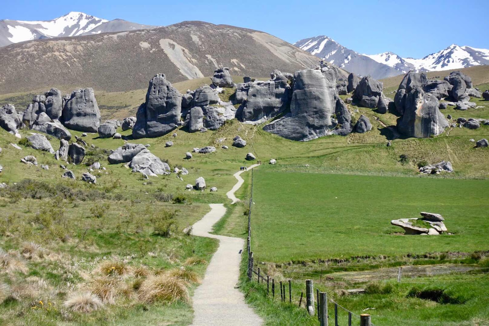
But our first full day there was spent driving toward Coleridge Lake and stopping along the way at Castle Hill Rocks a limestone rock formation phenomena, that is a complete anomaly in the landscape with towering spire like rocks, 300 million years old, where you can freely play hide and seek among them. Then onwards onto a gravel road toward the lake, where we met no other vehicles for 15 to 20 miles, but a group of campers on horseback composed of 5/6 guides and several pack horses for maybe 5 or 6 vacationing customers.
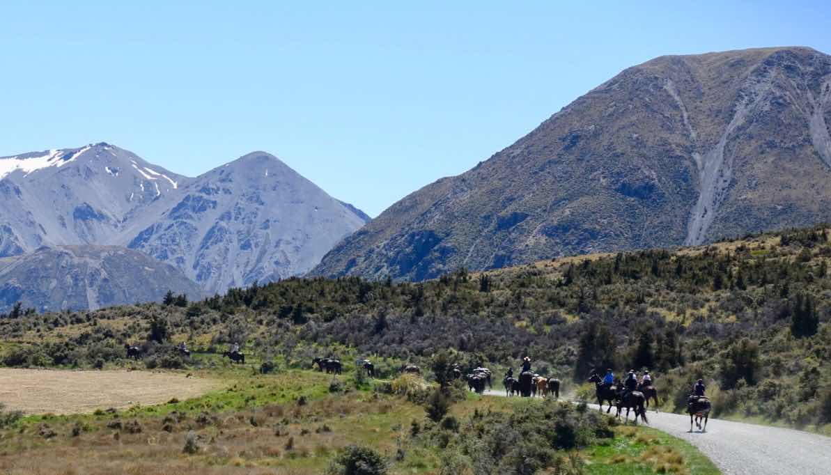
(Oh well, there are sometimes other tourists)
I often thought about them, as we passed them on the last good day before several of horrible storm laden cold days, that swelled the rivers, doubling them in size making roads impassable. But that day we enjoyed the crystal blue sky and lake edge solitude, where we noshed our brought lunch, after which we took the long way back to Athur’s Pass through Victorian like villages such as Darfield and Springfield where, while having a beer basking in the setting sun, a local hillbilly spouted his knowledge of alternate currencies such as ripples, which we had never heard of.

(The weather gets worse during our escape from Arthur’s Pass)
The evening in the bar at the Bealy Hotel we enjoyed lambshank and watched a local downing 32oz beers one after the other, amazed he was still standing after 6 of those and never visiting the loo in the meantime. When we retired to our room down the hill we hoped to see the resident fox to no avail.
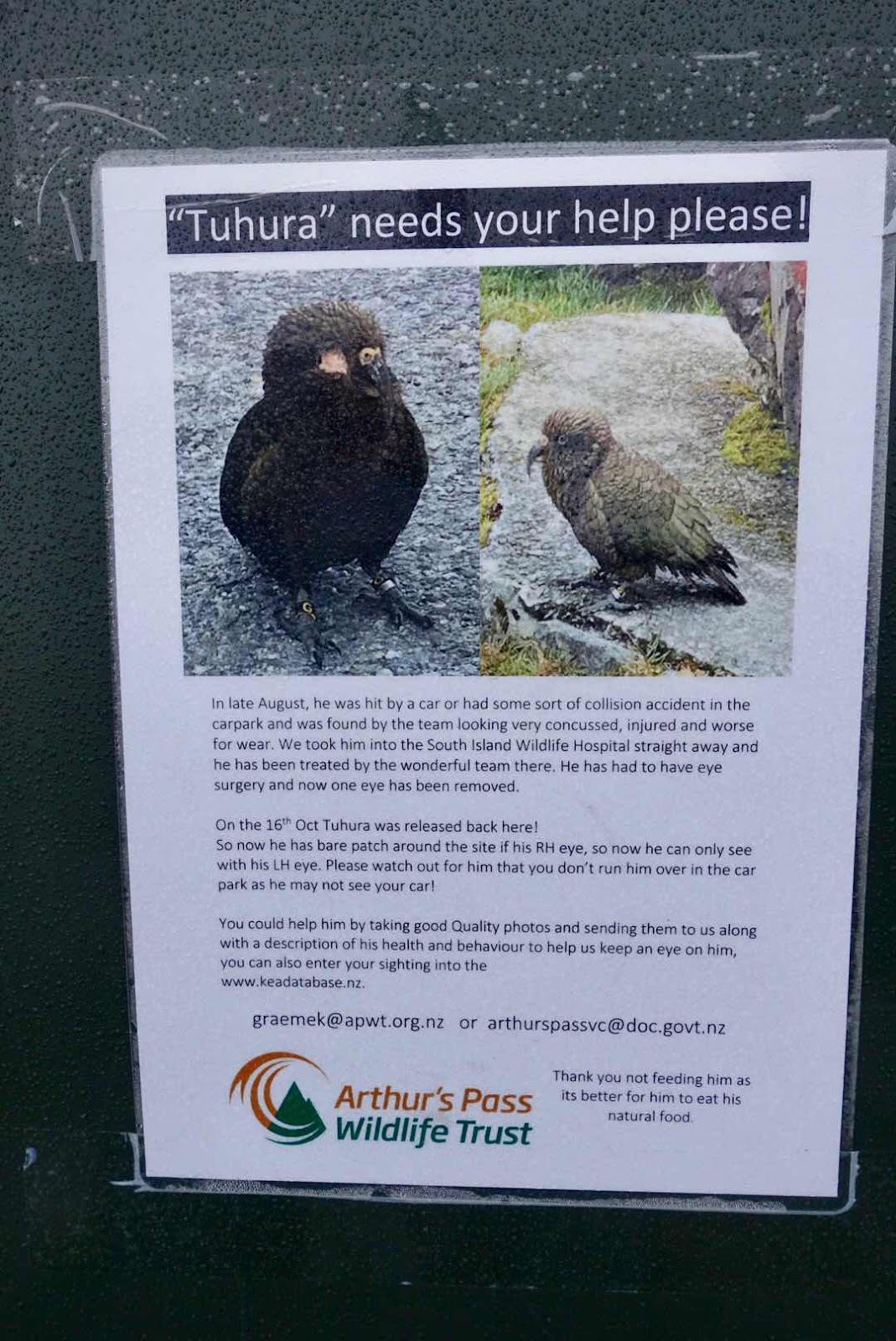
(We found one eye Tuhura and reported him as requested)
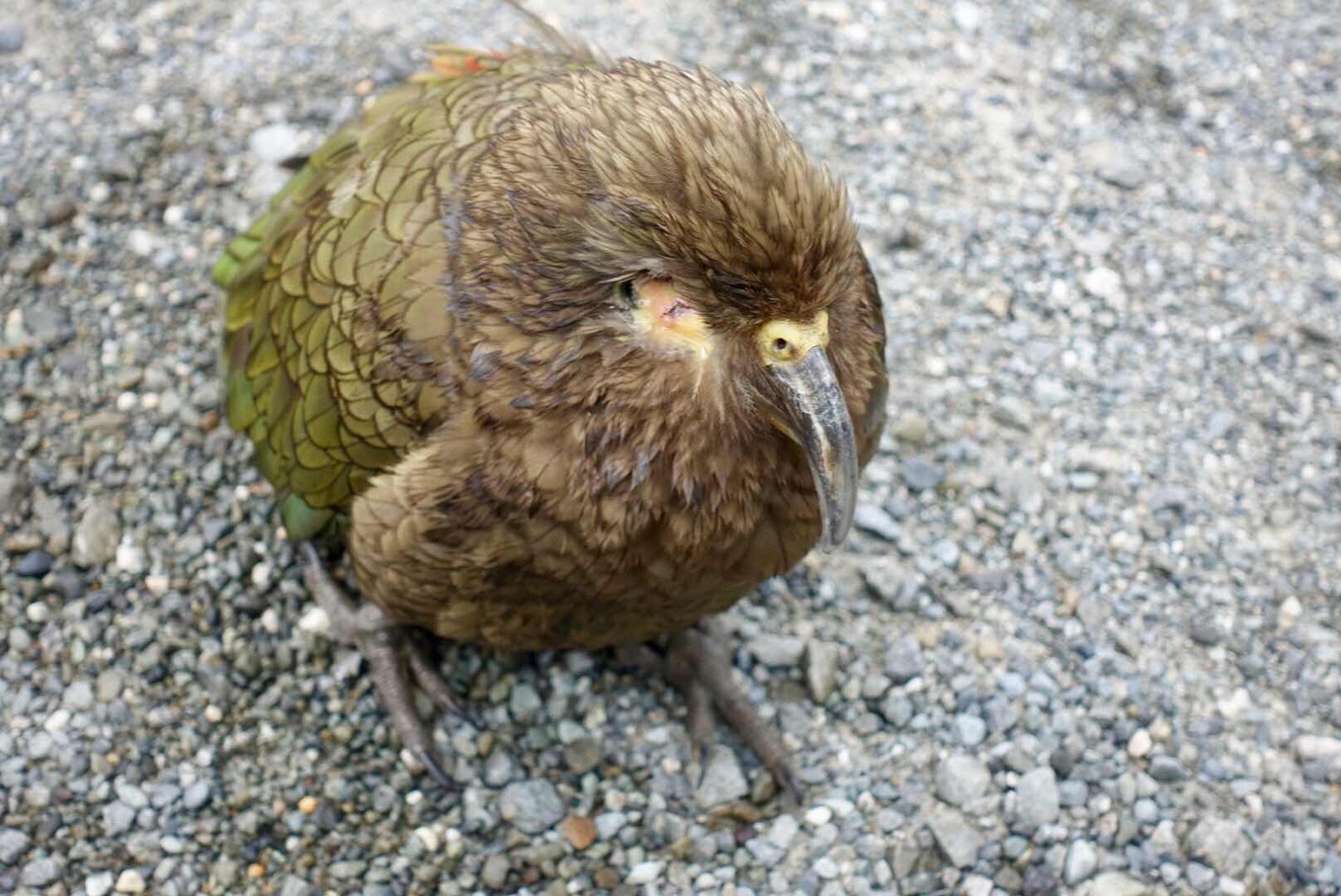
(Kea’s are getting rarer in numbers, but stay too curious and this can be found
where people congregate like parking places)

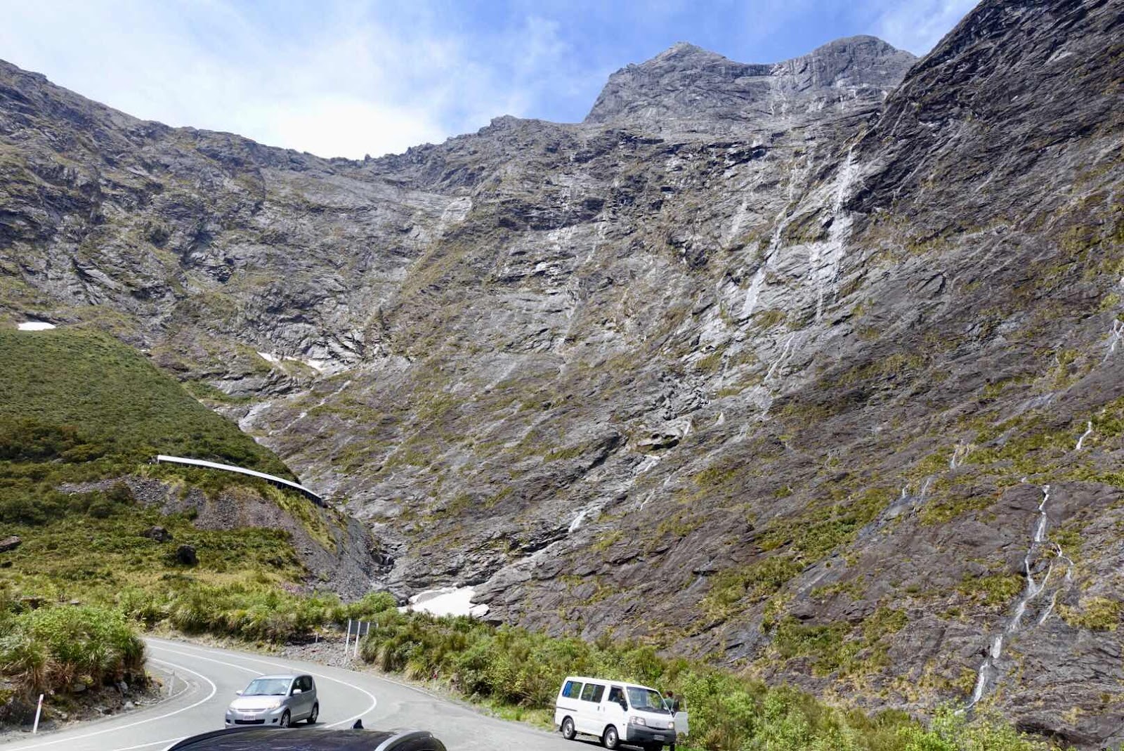
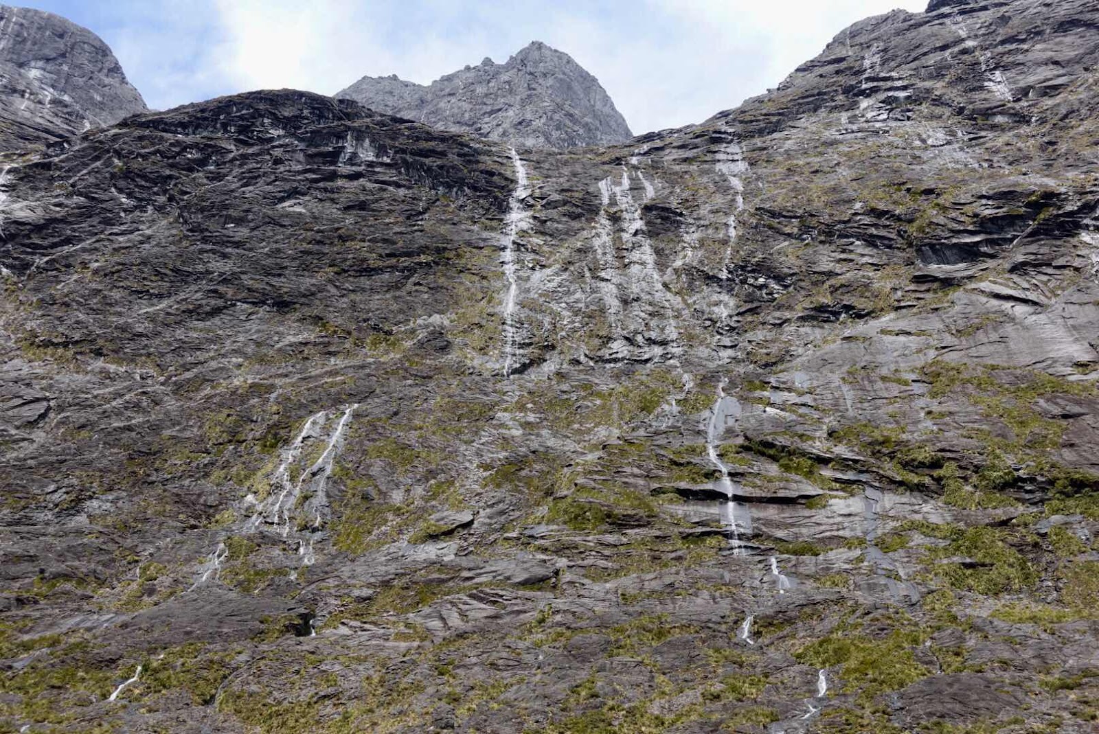
It was the fateful next day that pictures are needed in order to tell the story. The day we were supposed to drive to the Franz Joseph glacier for a one night stopover on the way to our next base Queenstown. The mountains around us had disappeared in fog, rain and howling scary storm winds that shook our car, constantly trying to hurl us off the road. The river alongside the road had swollen to a raging turbulent foamy swirling vortex of water, ready to have us disappear forever if it ever entrapped us into its mighty flow.
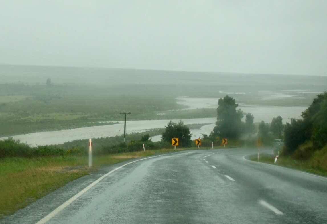
(These pictures miss the sound of howling wind shaking the car)
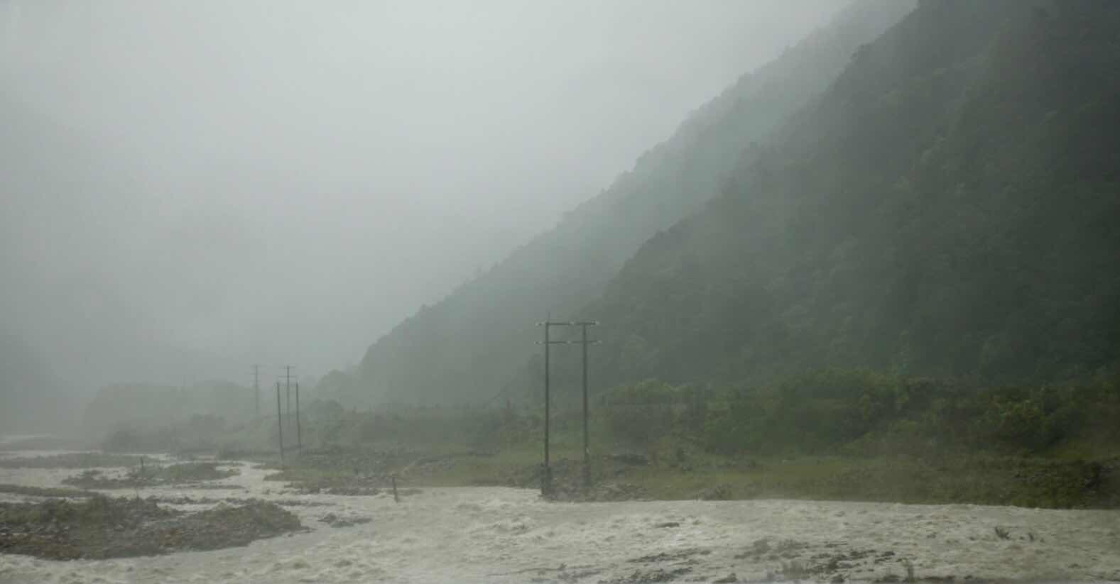
(And a picture does not show the speed of the raging waters)
We were very thankful to be alive, when we ended our mountain descent onto the two lane ringroad and were in definite need of a coffee stopover when we drove into Hokitika village that late morning.
The weather here was rainy but less windy. As we continued south toward our next stay we saw a lonely camper half underwater as we crossed a bridge. It had apparently overnighted at the river’s edge and was caught by the doubling in size of the swollen river.
A few miles further down, a flag man stopped us and informed us that because of a “slip” the road was blocked till crews could make it passable again in “maybe a few hours from now”. So please turn around and have lunch, before trying again. Long story short the road was never cleared that day and in the meantime there was no place in the area that had beds for the night anymore. So cancel our hotel in Franz Joseph by phone and we found a B&B in Greymouth on the web for ridiculous money, only to find nobody home when we arrived. So onwards we went in northern direction in search of a place for the night. As luck would have it, the place we had lunch at had one room left. There during dinner we met several day trippers who had taken the daily steam train tour from Christchurch to Greymouth also stranded here, the primary rail/passenger bridge which crosses the pass had washed out just after the train came through - us too!
(Told you that we had spring, summer, autumn and winter all in one month)

(Leave it up to you to put a season to this picture)
The next day the latest on the “slip” being cleared, still unknown, brought the decision to cross over the mountain ridge driving the 11 hour long way to Queenstown. It was then, that we found that a few hours after we crossed the day before, one of the bridges in the raging storm down the mountain had collapsed taking a local mother of 11 to her death and making it impossible to use that pass. We drove one more pass up further north and made the arduous trip, having us arrive to a setting sun in beautiful Queenstown, where nothing suggested we had ever endured the weathers of the days before.
(Views from our AirB&B balcony in Quernstown)
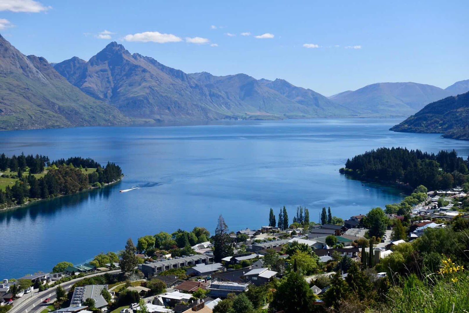
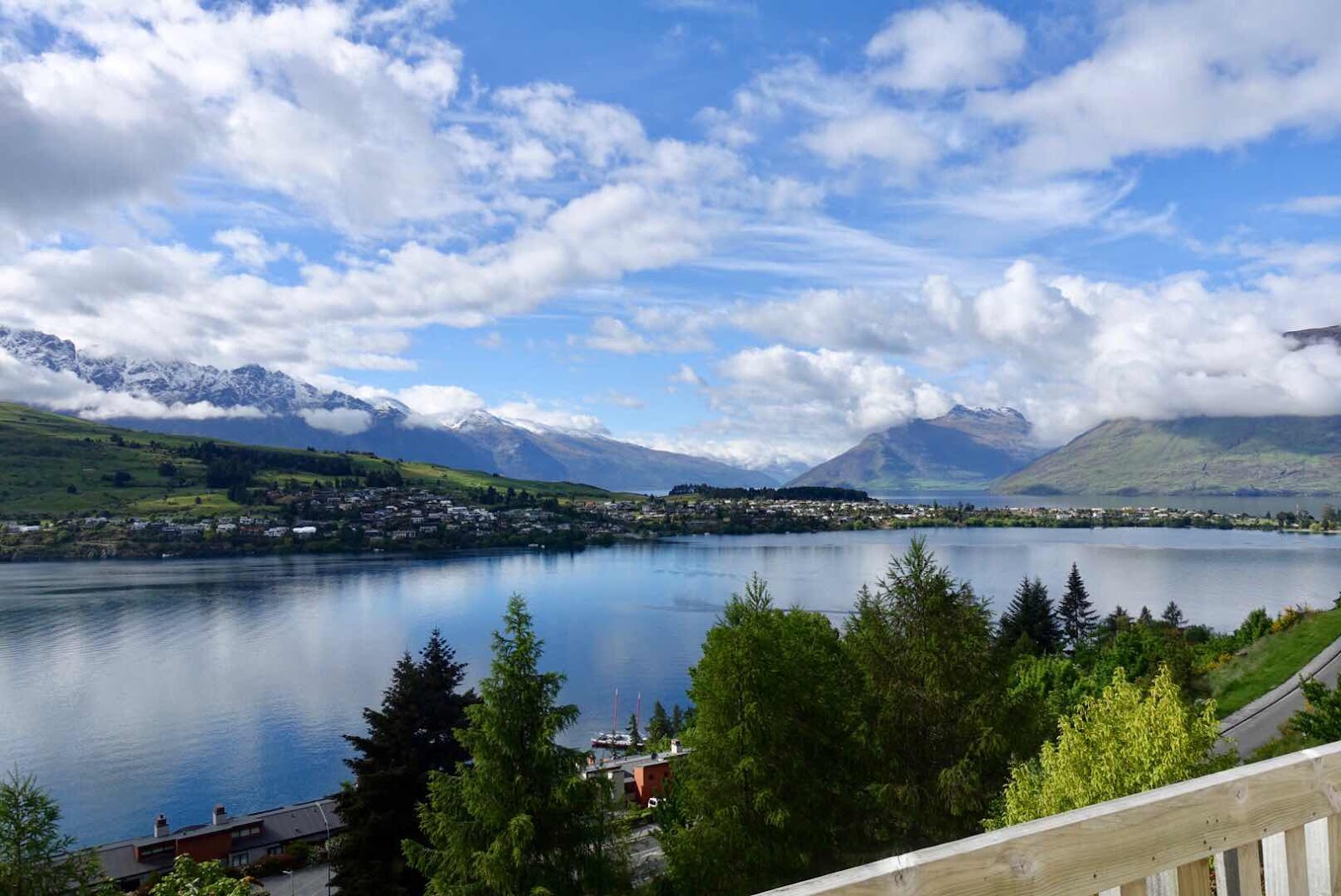
Little Queenstown is a cute town on a lake surrounded by steep mountains, rising straight from the lake, so that many homes seem “stapled” to the slope, each above each other, all seem to have balconies so one can savor the views. The picturesque little downtown mall invited us to have grooming time, laundry done and culinary adventures. Since it was shearing time for the largest population in New Zealand, the sheep, Sandee emerged with shorter hair than I have ever seen before, leading her to complain about the dominance of grey hair.

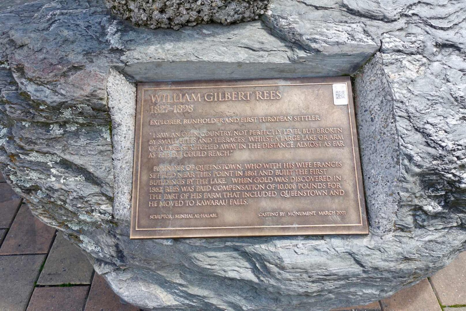
(Downtown statue of first city settler and his money maker)
We visited an underwhelming Kiwi preserve, where one tries to discover the famous national animal in the pitch dark as they are being fed. We stood in line for a cable car ride to the top of the surrounding mountain ridge above the city center, till we saw the ticket price of $80 pp. and decided to spend that money on a tapas lunch at the lakefront instead.

(We spent our days here just relaxing and less touring)
(Made me smile)
(Didn’t I say earlier that nature never ceases to amaze me)
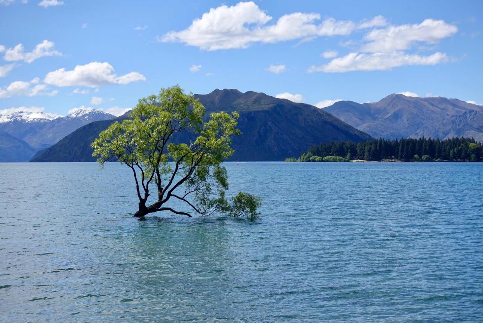
After 2 of these “vacation days” halting our touring, we took a day drive to Wanaka lake, stopping at one of the many wineries for lunch, to see the “famous” lone tree, a 70 year old “most photographed” crack willow tree (I had never heard of a “crack willow” tree), ending that beautiful spring day with a six course tasting menu at the not easily found Bunker restaurant.

(Drinks before dinner around a gaslit fireplace during our
Queenstown visit)
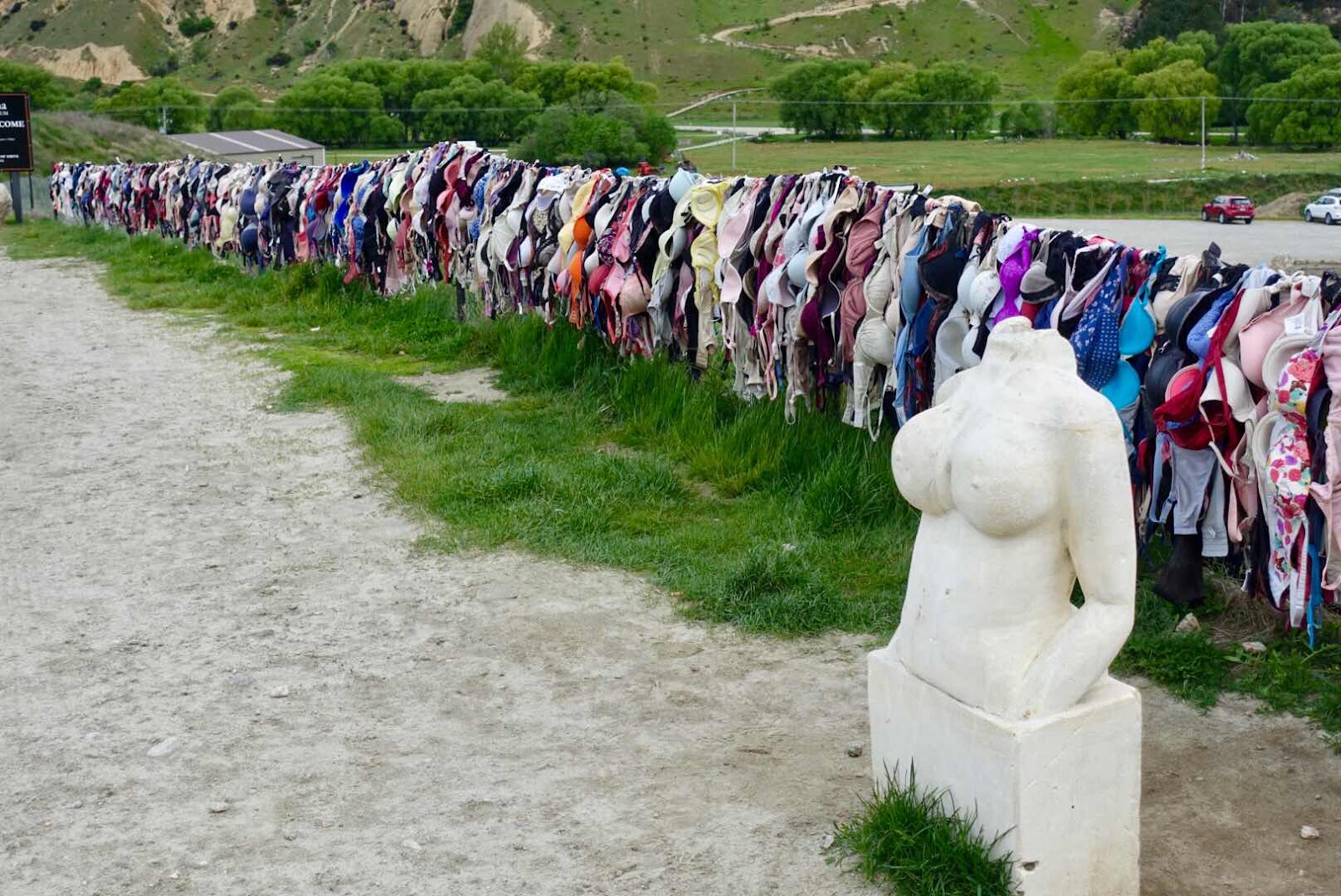

(On the one day outing from Queenstown we encountered this monument
against breast cancer)

(And we encountered another now two-eyed Kea when stopping to see below)
(Raw imposing nature)
(The crack willow tree that was the reason of our outing day from Queenstown)
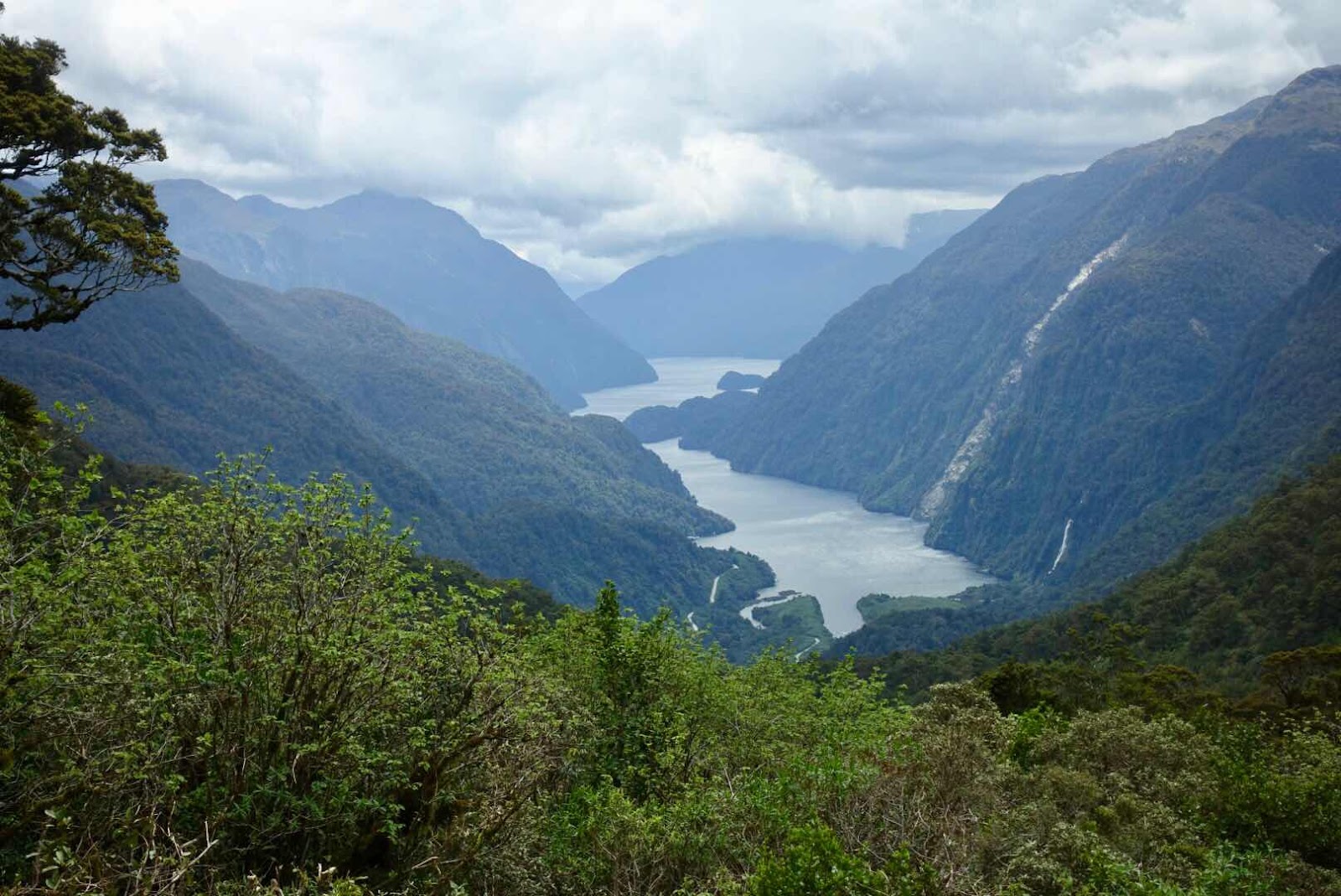
The next stop on this nature trip was to Te Anau a township in the Fiordland National Park in the most southwestern part of the Island, famous for its 2 well visited sounds, the Milford Sound and the Doubtful Sound. Less than 2000 inhabitants cater here to tourists.

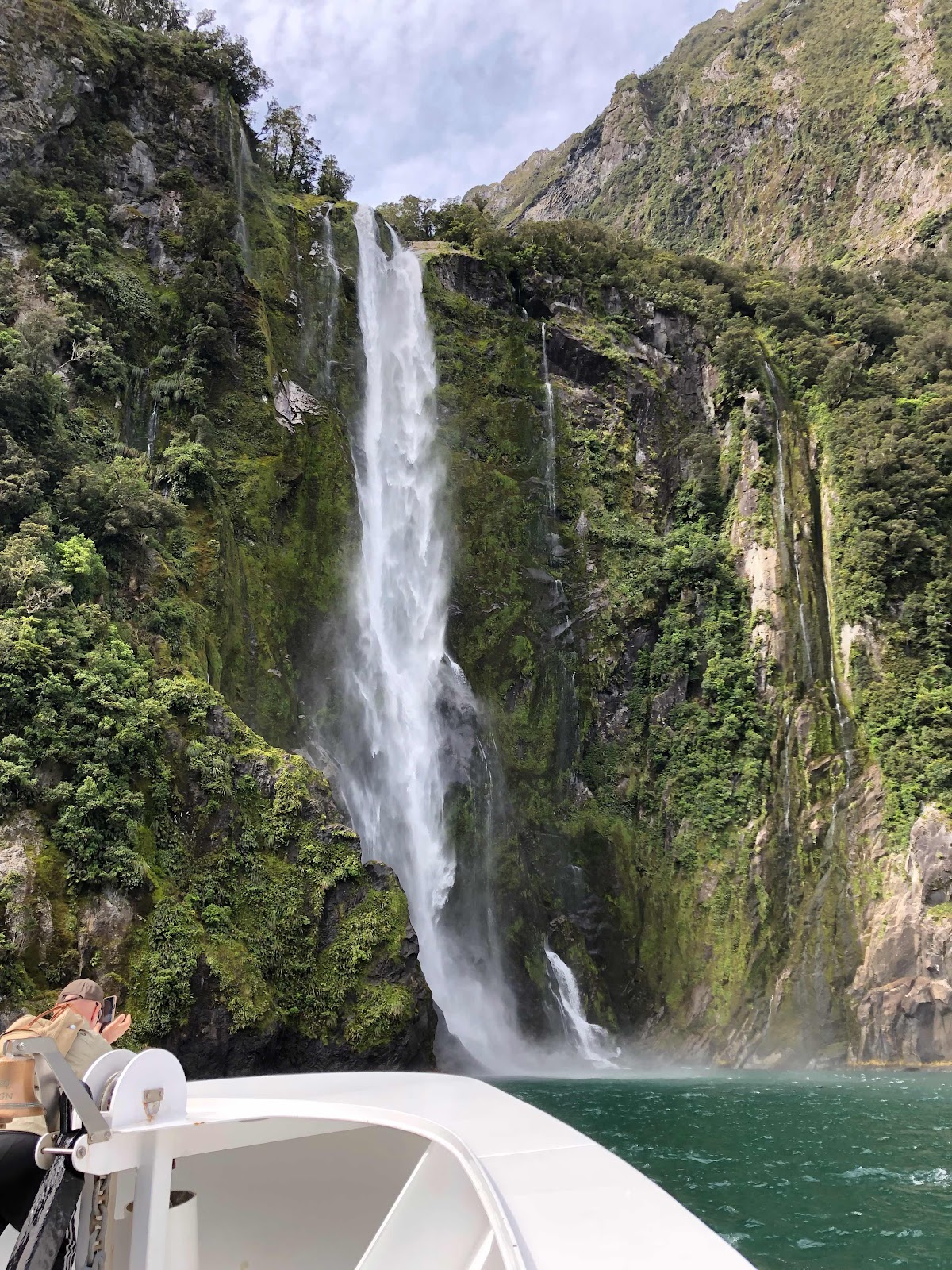
(Milford sound on a cloudy but still sunny day)
(The low hanging clouds gave Milford Sound the feel of being a more the lonely place it is)
We started very early to reach Te Anau late morning to have lunch and afterwards continue for a one and a half hour drive to Milford Sound so we can make a boat trip that afternoon on the sound, to then drive back in order to make dinner that night at the Distinction Hotel.
(Doubtful sound from a distance)
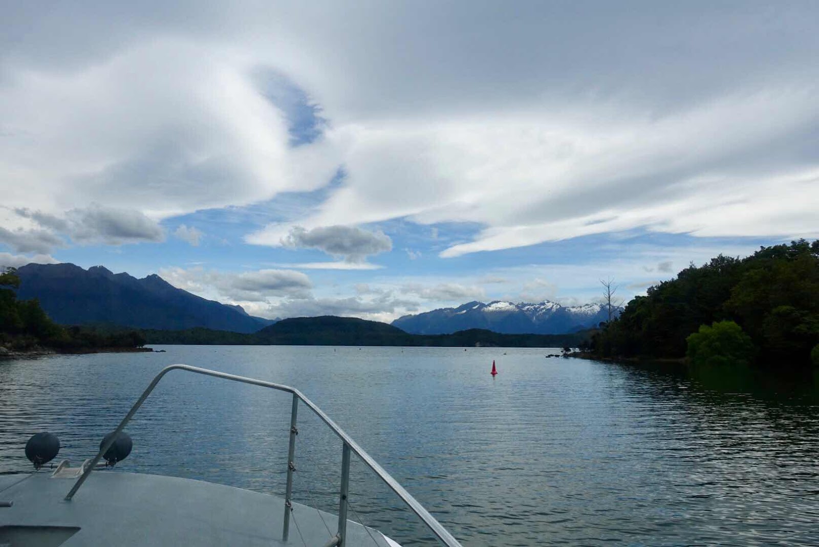
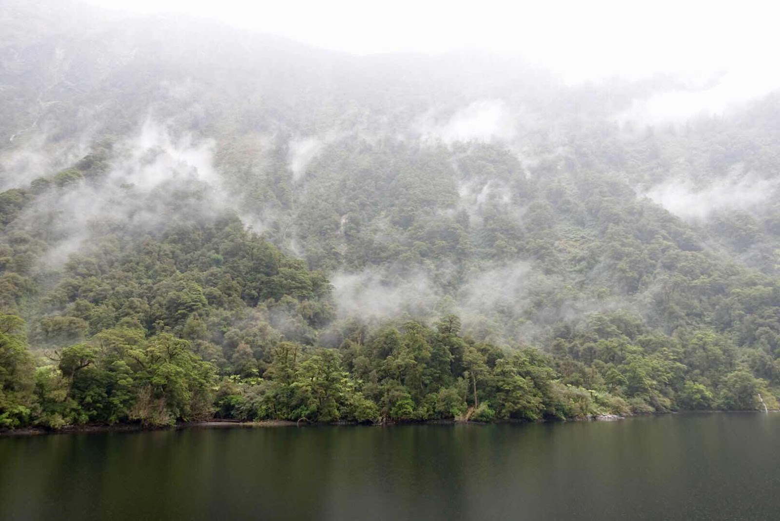
The highlight of that part of the trip was an overnight boat trip on the Doubtful Sound next day. To reach the sound we crossed Te Anau lake to a location called Maripou, where we had a bus trip over a high pass to the landingspot of the ship Navigator at the Doubtful Sound.
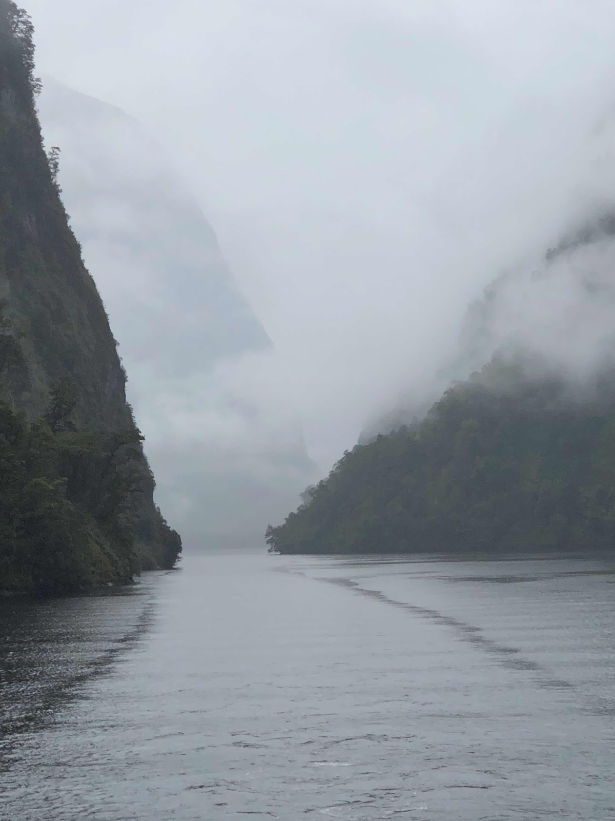
(This overnighter was more eerie)
(Low hanging clouds as sun sets)
(An earlier more bright picture)
I will never forget the deafening silence for 2 minutes, when the captain turned of the engines and asked us to turn off any sound making piece of equipment as well as to stop talking, in order to listen to the sounds of nature in a mist laden Doubtful Sound, where no humans live and where all that one senses is, being surrounded by mountains steeply rising from the water all around us, allowing us to hear only birds, water and rustling trees moved by the light sound of a breeze. I am so grateful that I have pictures that may give you that sense.

(Thousands of glow worms (a native fungus gnat) hang from the ceilings making the eerie look of starry nights as well
as shiny bead strings)
After we returned the next morning again by bus over the high pass and boat in Te Anau we took the other highly advertised tour: the glow worm cave trip, where 10 plus tourists glide by open boat into a very dark cave to look up towards the ceiling, expecting thousands of little light points as twinkling stars: worms in that stage before becoming amorous flies, destined to die in less than a few days as a consequence of exhausting indiscriminate copulation.

(As we were not allowed to make pictures in the caves this one
And the one above come from their website)
To our disappointment the number of twinkling lights was not as numerous as described in the brochure. But as the guide explained the phenomena is seasonal in this 10 plus months cycle of life and as it was, we witnessed them in the early stages of their season, where most eggs had not yet developed into glow worms.

(A small village of Cromwell where we stopped for lunch meeting farmers John and Joy)

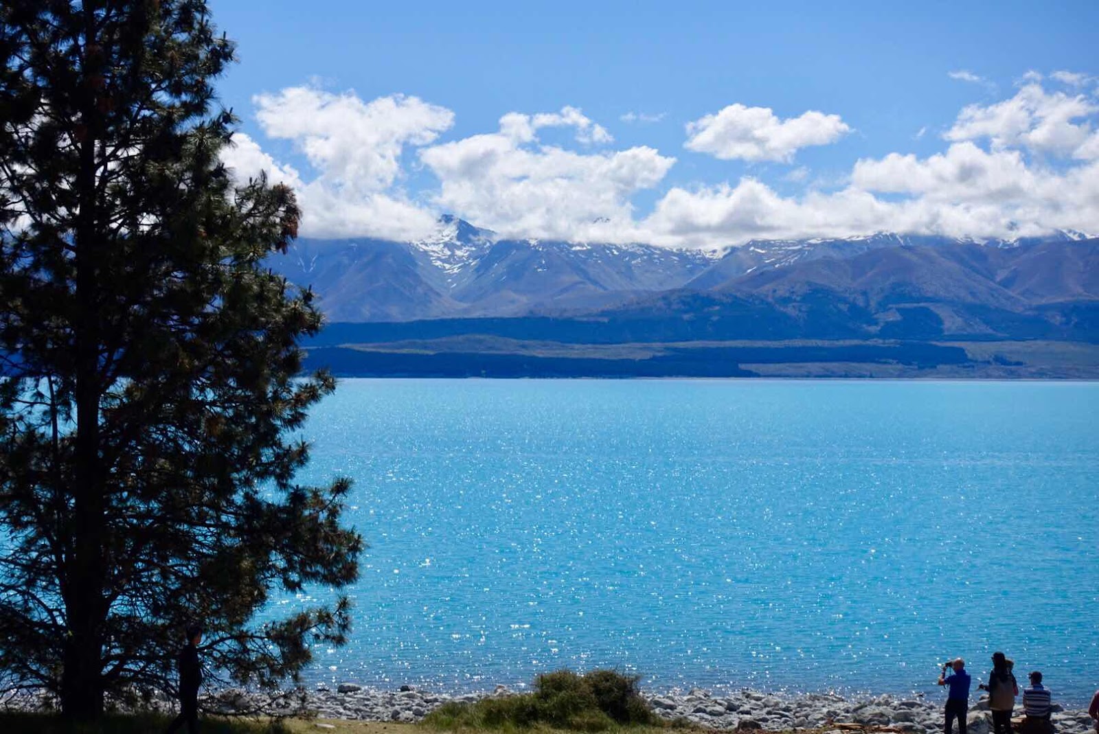
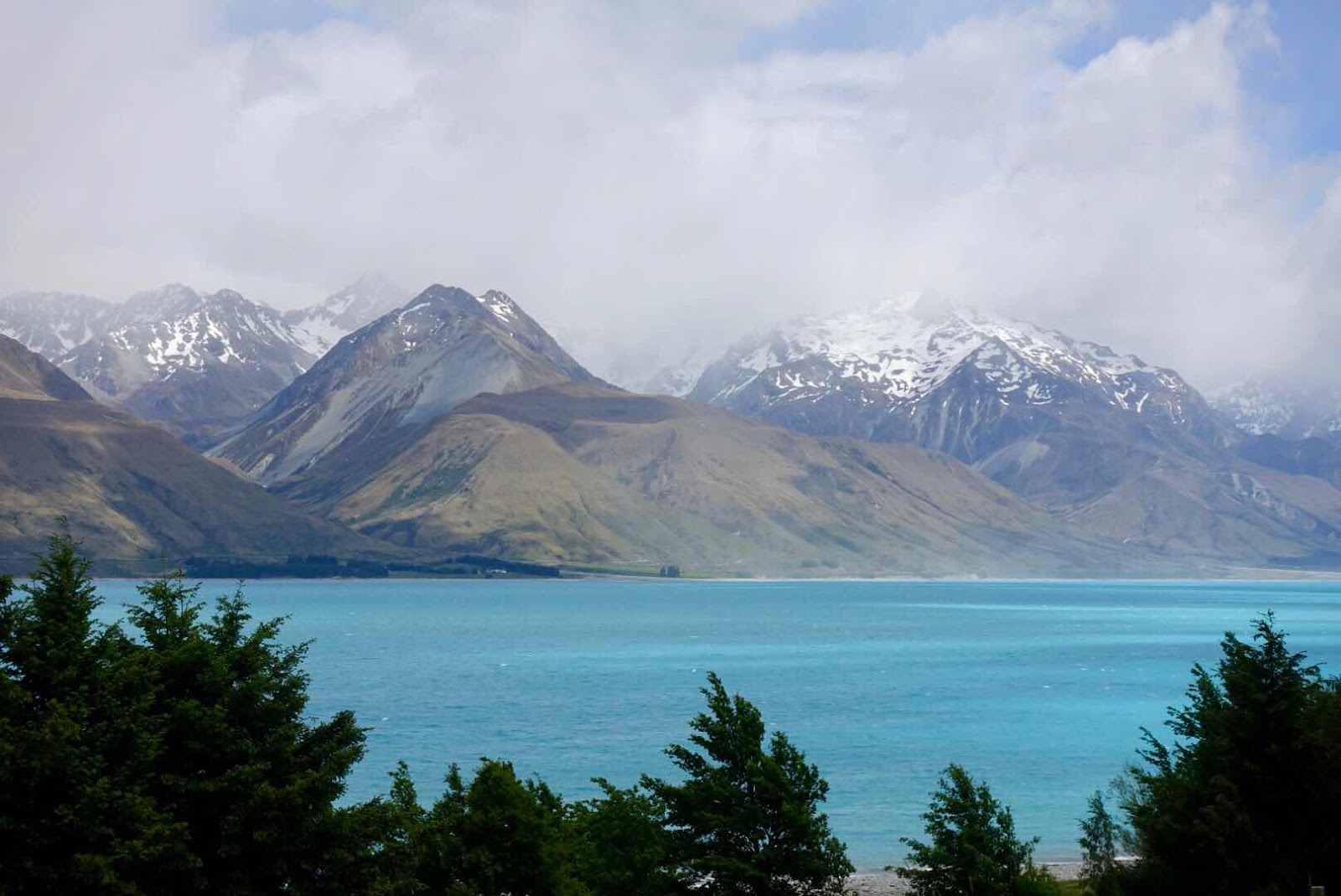
(Lake Tekapo in all its beauty)
The fore-last stop in our tour here was our stay in the highlands of Lake Tekapo, a truly light milky-turquoise lake, colored by the fine rock-flour (that has been ground over eons of time) ending in the lake, drifting suspended in the top layer of the clear ice fed waters of the lake, as it is positioned right at the foot of snow capped Mt Cook the highest mountain in New Zealand.

(Our rental in Lake Tekapo)

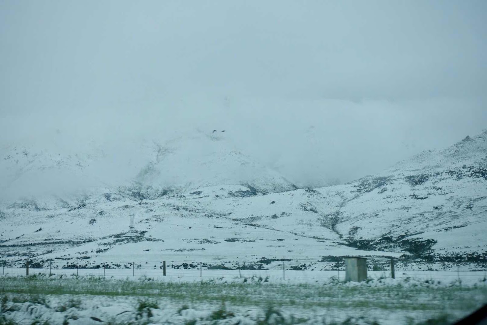
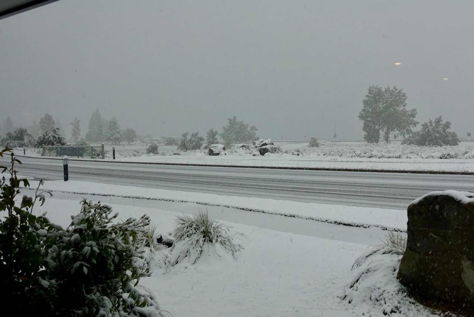
Lake Tekapo is also famous for its Dark Sky Reserve, where stargazing is best done on this part of the globe. Unfortunately during our visit the clouds covered the stars every night, but those clouds brought us an unexpected blanket of snow to awaken to, a winter landscape not often witnessed during this time of year.
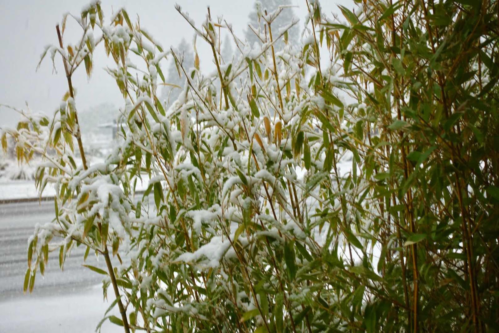
(Next day “winter storm” bringing snow)
The drive towards Lake Tekapo is one of those beautiful drive through valleys and past lakes such as Lake Pukaki, past cute little villages like the village of Cromwell where we had a nice chat with local farmers John and Joy, both in their seventies, about sheep and shearing done by roaming shearing pros able to shear a sheep every 2 minutes. (The world record we were told stands at 37.9 seconds).

(The day before the snow exploring Lake Tekapo area)
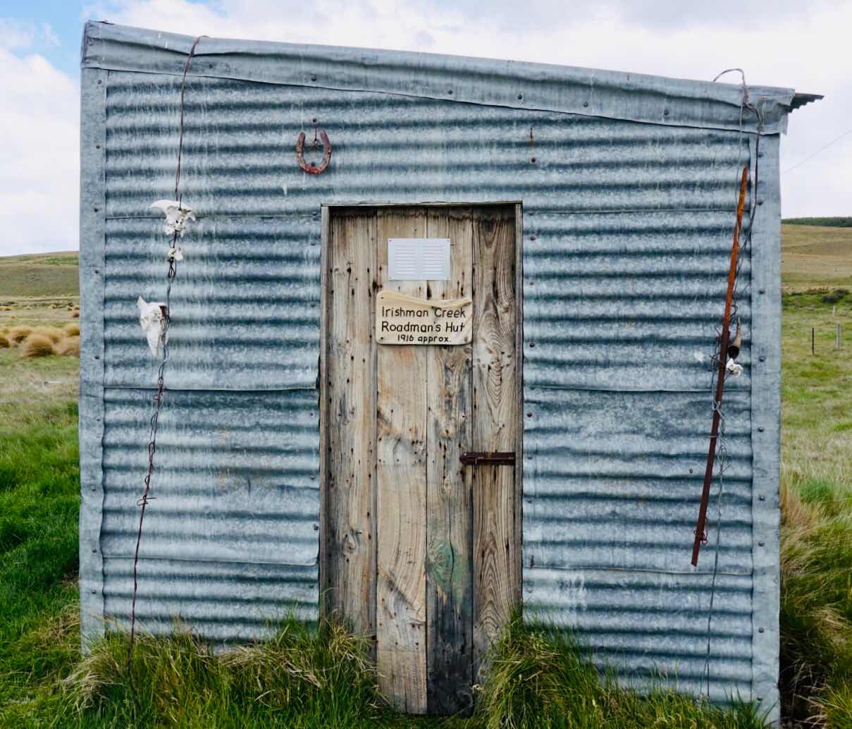
(Irishman Creek overnight hut for New Zealand at $5 a day travelers)
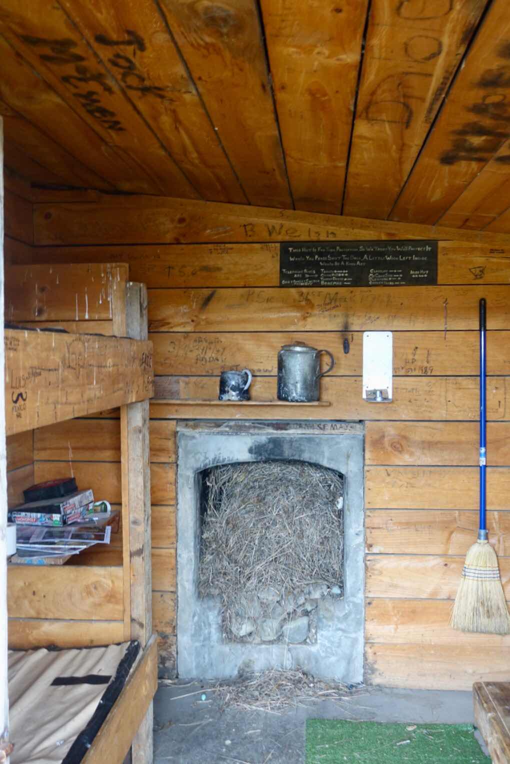
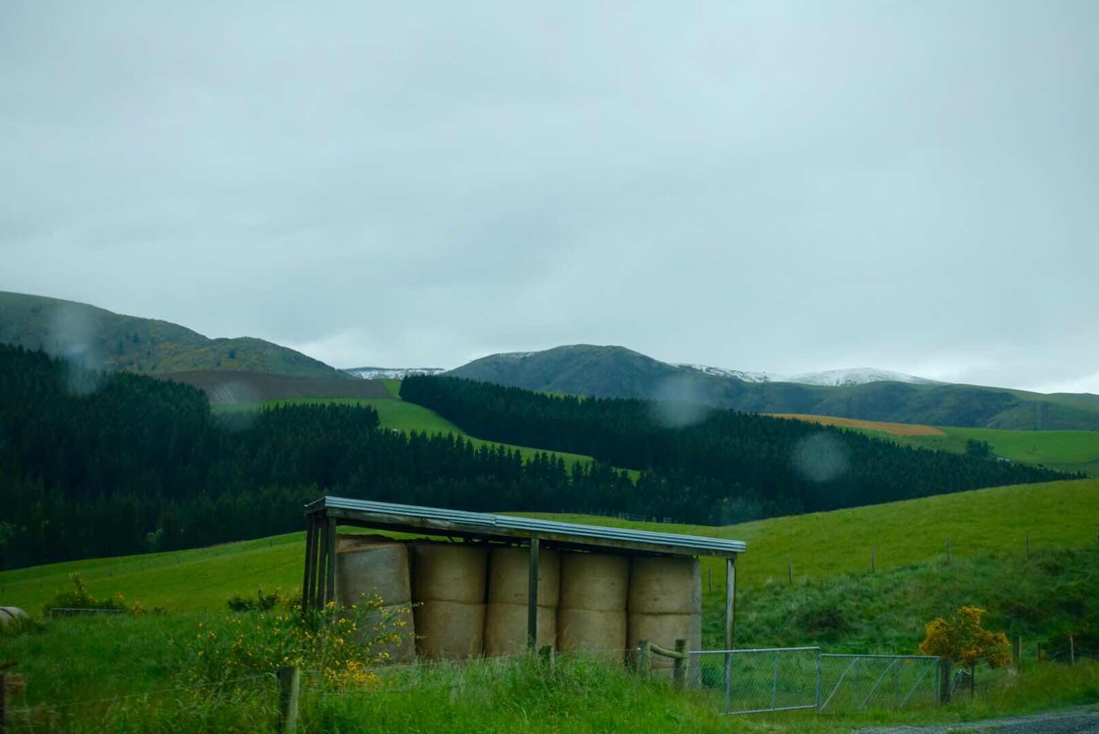
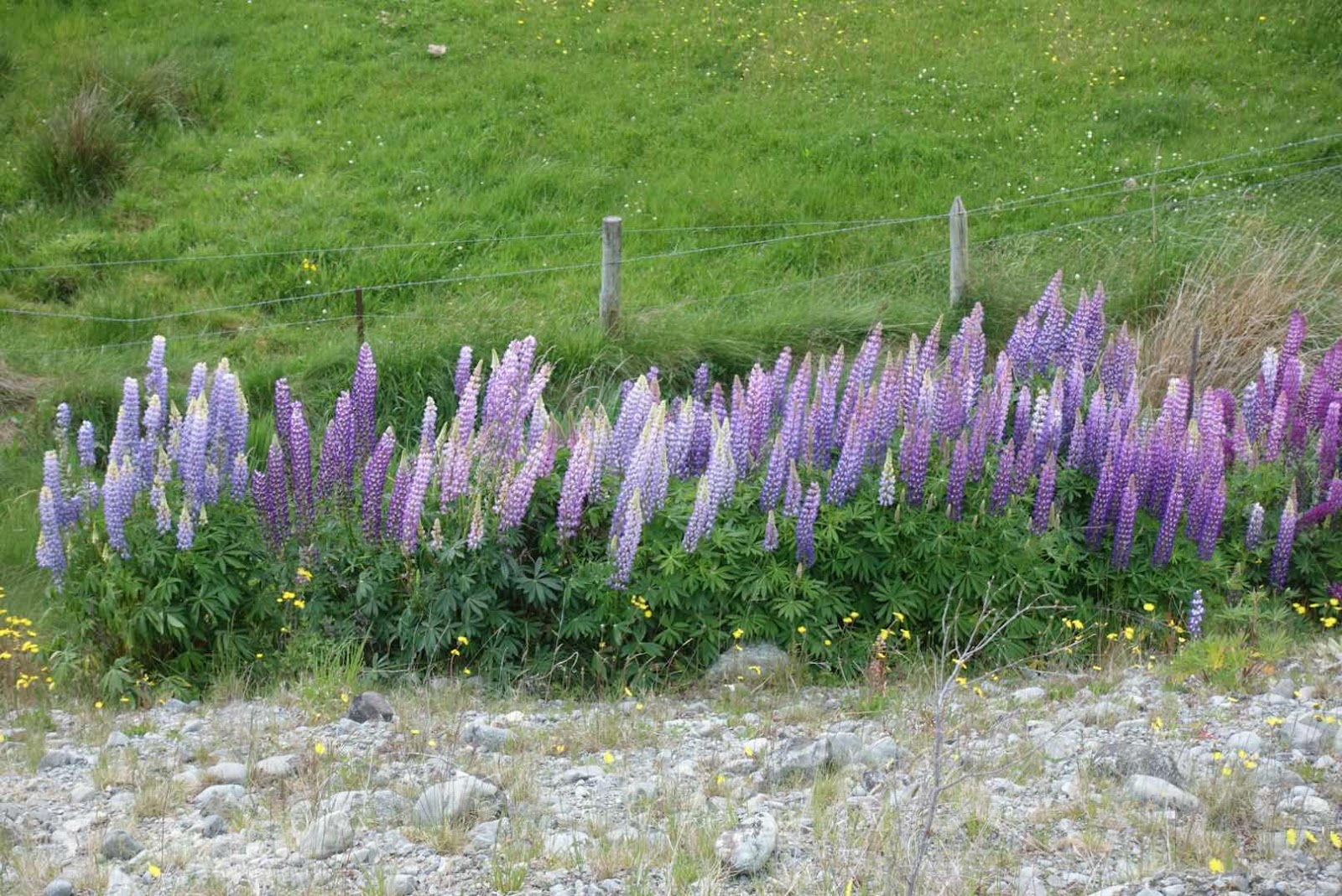
The drives around our rented one bedroom bungalow here in the highlands brought us not only to the bottom of Mt. Cook, but past historic mail drop shacks and an “Irishman Shack” still used by vacationers, who trek on foot or by bicycle these highlands over multiple days, for them to overnight in. Lupines color the roadsides, named paddocks and unwelcome signs with death threats are posted at the entrance to large farms. All in all idyllic drives on sundrenched days on gravel roads off the beaten track, till the weather turns ugly with wind and hail dropping temperatures to near freezing point.
(Sandee has been taking roadside pictures of flowers for as long as I have known her)
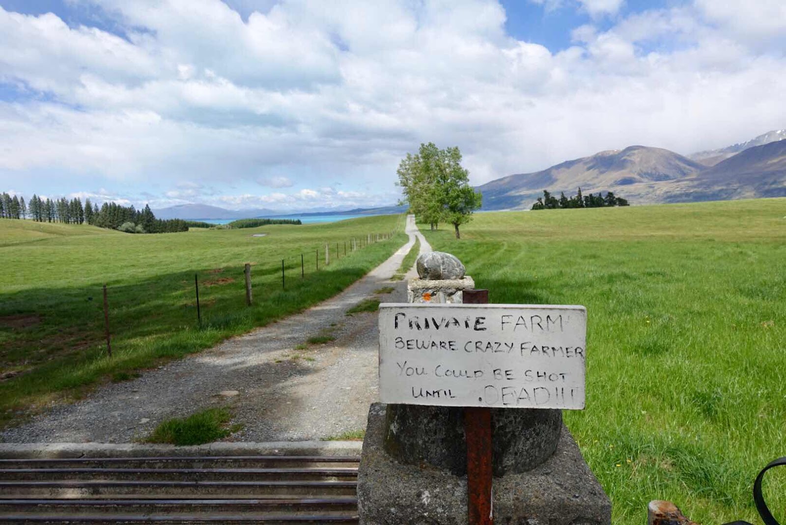
(The farms here are humongous occupied by farmers who treasure their privacy, as this sign attest)

(Lake Tekapo and lupines)

(Prairiegrass fields teem)
As already mentioned we awoke the day to leave for Christchurch to a snow covered wonderland, making me worried that the pass we needed to traverse to the NZ capital might be closed. That fear turned out to be unfounded. The only calamity was a passing truck spitting gravel onto our windshield resulting in a reportable crack.

(The empty road down the highlands to Christchurch)
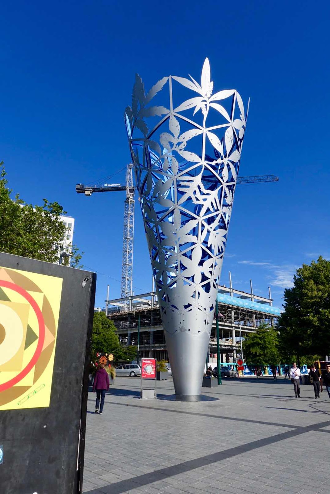
(“The Cone” beside Cathedral Square)

(The ruins of Christchurch Cathedral today)
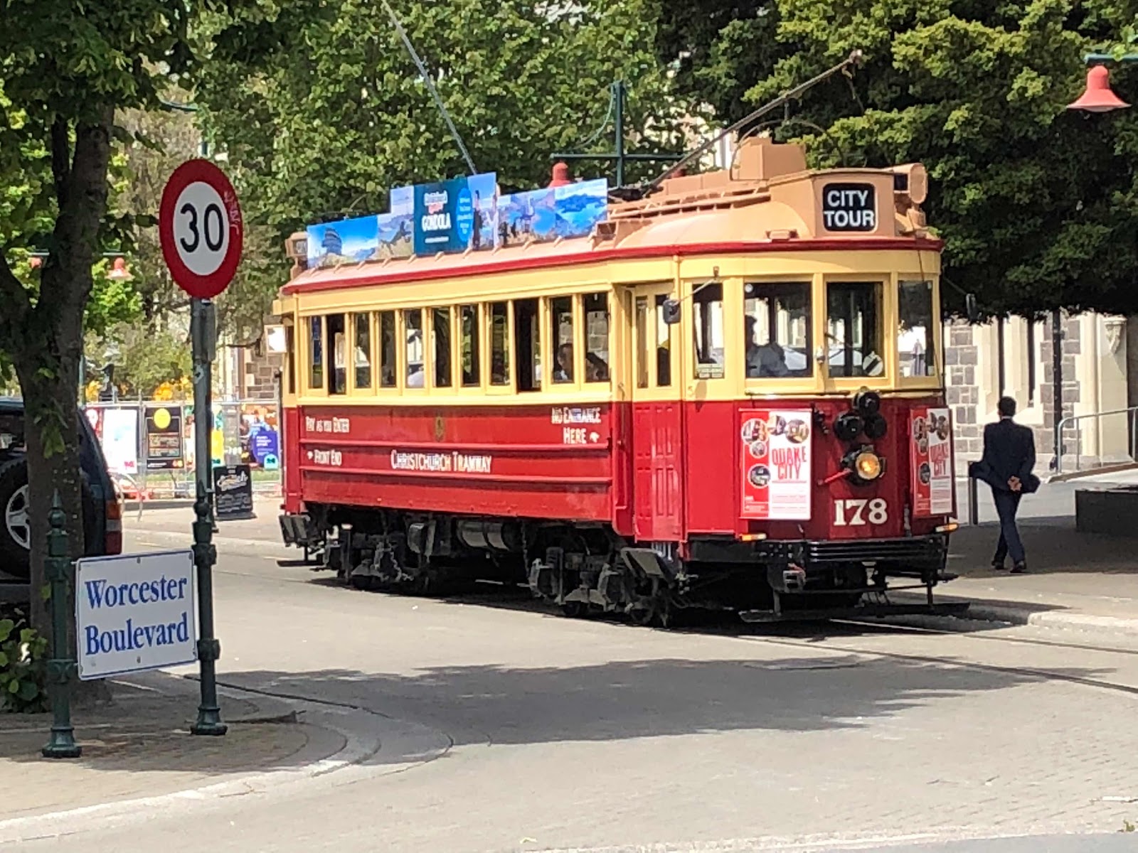
(The iconic tram - now tourist only- in downtown)
Christchurch is a city still showing ruins of the two earthquakes it endured.
The first one shook the city on September 4, 2010 with a 7.1 magnitude. But it was the second one on February 22 with a 6.2 magnitude that destroyed the weakened city causing 185 death and thousands of wounded people. And 7 years later during our visit we witnessed a very slow rebirth that was somewhat architecturally muddled, and made us wonder who was in control of the planning commission.
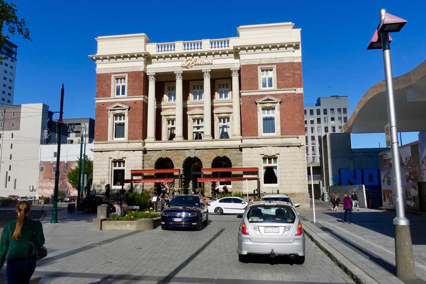
(Our AirB&B located in this historic Heritage Building)
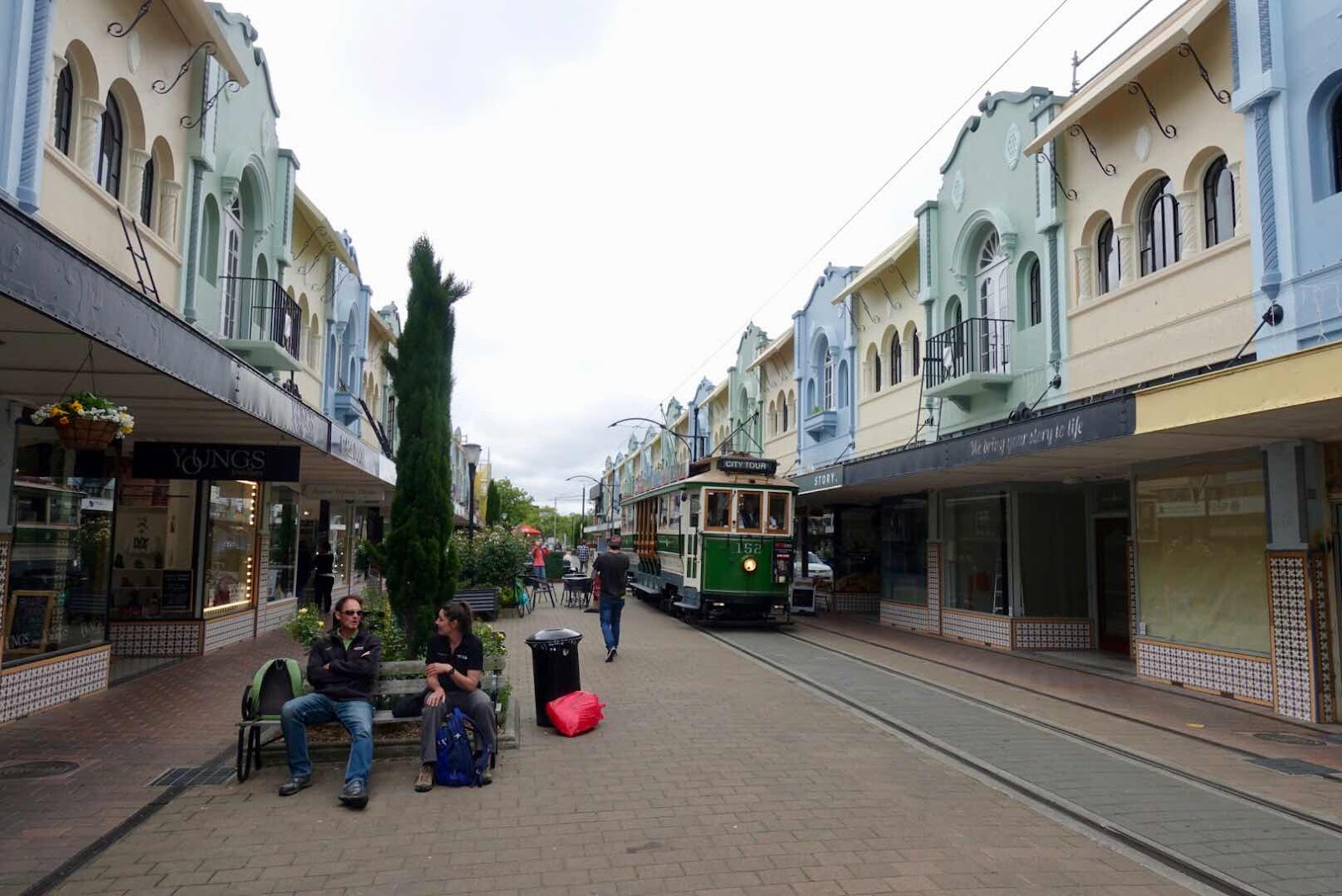
(Restored Street one of the very few)
We had found an Airbnb inside the Heritage Building a surviving structure from 1913, housing a hotel and apartments smack in the center of what is left of downtown. The visitor bureau sold us a multiple day pass to all one wishes to see and do in this city and we booked a walking tour with a retired architect named Gordon. Vintage trams from the beginning of the 20th century, connected us to many a sight ranging from ruin to rebuilt streets and the beautiful botanical garden from where we also took a gondola over the Avon river, poled by period dressed guys as if we were transferred to Venice.

(Botanical Garden Beauties)

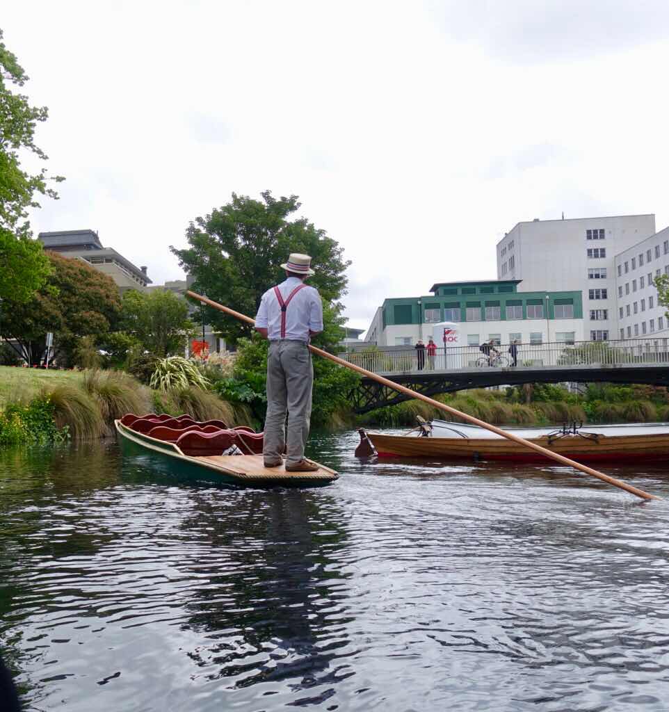
(We also got peddled on the river Avon)

(The other must do in Christchurch is going up by cable car
to see the other side of Christchurch)
(The other side of Christchurch borders a volcanic lake
with open access to the Pacific Ocean)
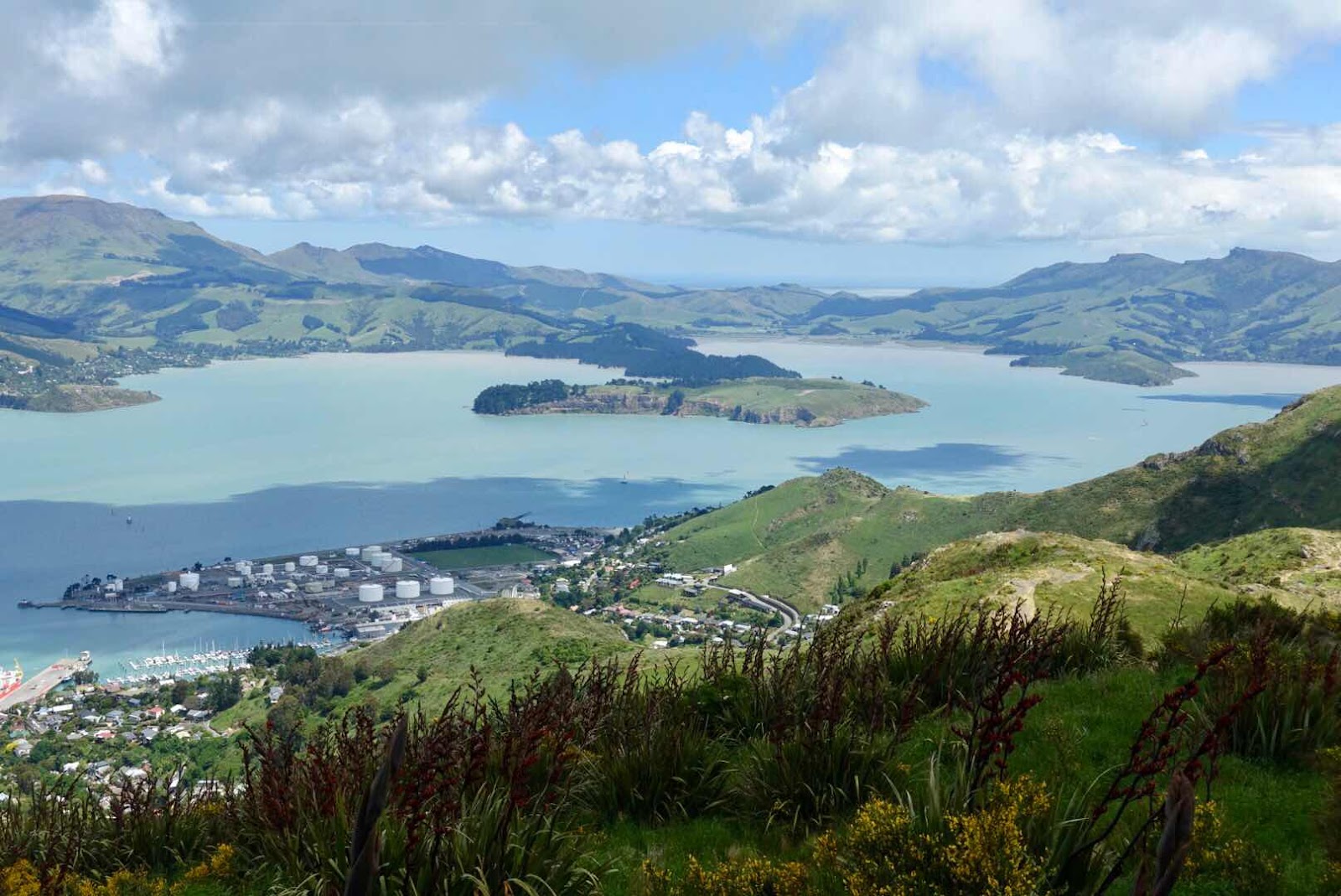
A gondola cable car brought us up a surrounding mountain ridge where we had beautiful vistas over the city and the South Pacific Ocean, as well as the oval natural harbor only to be reached by a tunnel, which turns out to be a former caldera that lost one side, thus opening itself up to the ocean and becoming a nicely protected natural harbor. The views from above were magnificent.

(University Courtyard highlights the provincial feel of this city)

The walking tour with Gordon, gave us the nitty gritty about restoration of the city, with battles with insurance companies still putting projects on hold, about the new requirements to rebuilt on earthquake resistant shock absorbing foundations as is done in major earthquake prone cities such a Tokyo, using technologies developed by the university of Christchurch, but never applied in New Zealand till after the earthquakes

(A result of the earthquakes was creating this seismic resistant cardboard church)
.

About the political battles at city levels that created the hodgepodge of new structures rising up on empty parking lots that blanket this city, where in the first year only demolition crews roamed developing these “parking lot” spaces, where maybe yes maybe no new structures would rise. The Christchurch cathedral still in ruins symbolizes the incompleteness of this city, as it is slowly, too slowly arising out of the ashes. And then Gordon suggested at the end of our walk we should visit the outskirts of town where before the earthquakes 10,000 plus homes stood on soil so liquified by the second earthquake that there will never be any building built there again, as the soil is so soft no structure would be possible there, as of now that land is like sinkholes in waiting.

(Land that before the earthquake had thousands of homes lay bare as the
soil is liquefied also named suffers from liquefaction)
(Below and above the results of liquefaction or soil prone to getting sinkholes]

We drove to that edge of town before turning in our Kia rental at the airport staring in solemn amazement at a green landscape that less than 10 years ago was dotted with homes and gardens, schools and shopping centers and now all that was gone to never come back again.
I hereby add an article with a video showing before and after as no words describe the disaster as well as arial pictures
As always may the pictures do this story justice

What a beautiful place! Wonderful writing and superb photography. Have friends in Christchurch so now the pressure is on. Plan to read this all over again—thanks! Margot
ReplyDeleteThank you for the magnificent pictures.. I enjoyed looking at them . The reading was captivating. ENJOYING life.
ReplyDeleteHope you both are doing well. Love to you.
Great story and photos! Thanks Erik & Sandee
ReplyDelete